Tag Archives: Visual Arts

‘The Kimberley’ Exhibition Online

Hi folks,

The exhibition, The Kimberley – Australia’s Threatened Wilderness has been run and won: they came, they saw…and one person even won (one of Hunter G’s images!). Scroll on for the full series of exhibition images and accompanying text . All images are available for sale. See end of post for sales info.

And for those who were unable to attend Bob Brown’s Closing Address on June 7 (or for those who just want to get lost in Bob’s inspiring words and gravelly tones once again),  a video of his speech can be viewed here

A big thanks to Dave Meagher and Singing Bowl Media for filming and editing this.

But now it’s over to the exhibition artists, Tom Montgomery and yours truly, Hunter G…

Artist Statement: Tom Montgomery – Watercolour Painter.

I am 23 year old conservation artist based in beautiful Broome, Western Australia. My passion is exploring the Kimberley’s pristine environment from its spectacular gorges, waterfalls, cave systems, isolated islands and pockets of lush rainforests. With no recorded extinction, the Kimberley is the Noah’s arch of northern Australia’s biodiversity. A complex and immense landscape abundant with unique wildlife.

Rugged terrain makes the Kimberley largely inaccessible, thus holds the key to its remarkable preservation. Rocky gullies have so far sheltered sensitive areas from most external influences such as raging fires and over grazing from livestock. At the very heart of this pristine wilderness we unearth its greatest threat, untapped resources.

A proposition that comes with a choice that puts the Kimberley’s future on the line. If we say nothing against industrialisation our limitless thirst for resources will decide the verdict.

Walmadan

Walmadan Coast

Shore Bird

Shore Bird

Squirrel Fish

Squirrel Fish

Barramundi

Barramundi

Kingfisher

Kingfisher – work in progress

Pelicans

Pelicans

GreenSeaTurtle

Green Sea Turtle

Work-In-Progress, 'Jamesy'

Work-In-Progress, ‘Jamesy’

Notes regarding the above portrait image:

The tedious work that Tom puts into his watercolours has transferred into the same level of discipline when it comes to creating his own unique portrait style. A style that seeks to capture the real spirit of the Kimberley people and their connection to the land.

This is achieved by collecting ochre pigments from the local landscape to enhance his work. When drawing inspiration from the vibrant colours of the Kimberley, Tom observes the elements as the perfect painter’s pallet

Pindan Technique

He first uses an interesting preparation technique that involves burying the cotton paper in raw pindan earth in specially selected locations. Once the pindan hues are embedded in the paper any excess dirt is rubbed away with a rag.

Dark tones are acquired by using charcoal from the camp fire which is ground up and applied to the paper with a firm brush and smudge sticks. Light values are then brought forth by removing the pigment from the paper with a kneedable eraser. Finally the work is fine-tuned with graphite pencil. Over the following days the pindan is slowly tamed and the Kimberley character begins to emerge from what was once dust.

………………………………………………….

And now…, it’s over to Hunter G’s images from across The Kimberley (nb. all images taken from the main highway except those at Walmadan. Just imagine what you’d get if you got into the wild and tasty innards!)

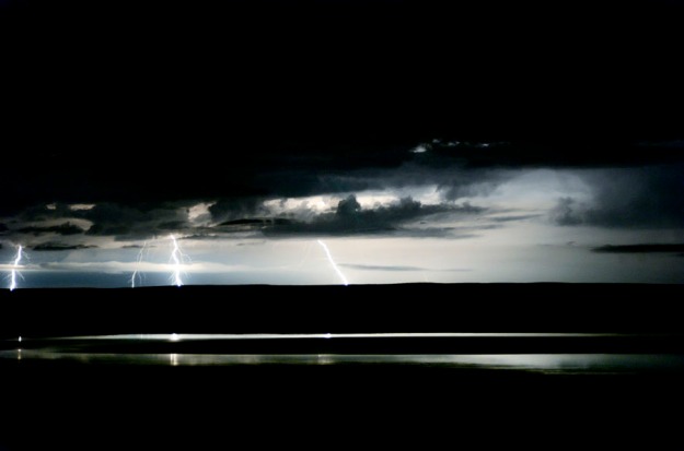
Electrical Storm

#1            Electrical Storm

Dec 31, 2012: 22:52

Latitude, Longitude: -15.450886, 128.11904

Here, from Five Rivers Lookout, in the Kimberley’s NE, one can see five rivers flow into the Cambridge Gulf: The King; The Durack; The Pentecost; The Ord and The Forrest.

I spent four nights living up here after the local policeman’s wife suggested I do so, despite the ‘No Camping’ signs. On the morning of day five, the ranger asked me kindly to move on.

Five Rivers Lookout has been listed as one of the world’s top lookouts and, for once, I’d have to agree. However, the recent addition of the Kimberley Metals Group’s iron-ore loading yard is a worrying sight. (refer #2)

Iron Ore

#2        Iron-Ore

Jan 1, 2013: 21:19

Latitude, Longitude: -15.44023, 128.114946

Kimberley Metals Group run this iron-ore loading yard, set amidst a sensitive mangrove and mudflat eco-system. Council signs in the area ask people not to drive on the mudflats, yet it is somehow ok to build this industrial site.

The ore is delivered from KMG’s Ridge’s Mine (refer image # 10) about 165km away. Road-trains up to 53 metres in length travel in both directions EVERY 20 minutes for approximately 20 hours per day. And this is a small-scale mine. If the Kimberley becomes the industrial hub Premier Barnett wants it to be, this will be catastrophic.

A few days later I was camping about 30 km from this yard at a spot called The Grotto (a gorge and waterfall) which is a few km off the main highway. Apart from nature I could hear nothing else…except the road-trains.

Tidal flats and mangrove forests are important ecosystems. They usually support a large population of wildlife and are often of vital importance to migratory birds, crabs, molluscs and fish. In the UK mudflats have been classified as a Biodiversity Action Plan priority habitat. The maintenance of mudflats is important in preventing coastal erosion. However, mudflats worldwide are under threat from land claims for development, dredging due to shipping purposes, and chemical pollution.

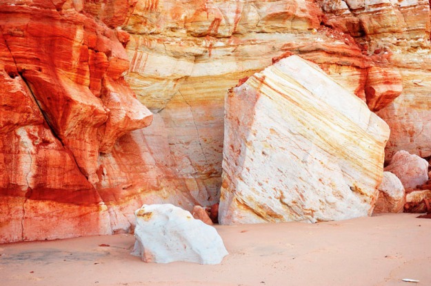
The Blood-Stained Cliffs of History

# 3       The Blood-Stained Cliffs of History

Feb 5, 2013: 12:07

Latitude, Longitude: -17.466437, 122.152138

These incredibly beautiful coloured sands and stone are just a couple of km north of Walmadan (James Price Point), the site proposed for the world’s largest ever Liquefied Natural Gas Processing Plant – the primary reason I undertook this project. Fortunately the proposal has been abandoned by the main company, Woodside Petroleum. However Premier Barnett is determined to build a massive industrial port in The Kimberley and he is still considering JPP.

If he is successful, a port would open the floodgates to industrial development, providing an export point for companies that cannot otherwise afford to begin mining. It is vital that a port is not built anywhere in The Kimberley. Over the past ten years there has been a 500% increase in mining leases across the Kimberley. Lack of a port is the main thing stopping many of them from beginning operations.

Mining Exploration in The Kimberley

Current Mining Exploration in The Kimberley – an horrific prospect for this incredible wilderness zone.

Ghost Dogs at the Cliffs of Walmadan

#4        Ghost Dogs at the Cliffs of Walmadan

April 10, 2013: 20:04

Latitude, Longitude: -17.489176, 122.142686

This is taken from James Price Point, looking south along what Premier Barnett claims is an “unremarkable piece of coastline” in a cynical attempt to fool the general public based on an ‘out of sight, out of mind’ approach. He knows full well that most Australians will never see this area for themselves.

It’s strikingly similar to former Tasmanian Premier, Robin Gray, who described The Franklin River as “a leech ridden ditch” during his attempts to dam The Franklin in the early 80’s. Post the campaign that ‘ditch’ became part of the South-West World Heritage Area. Post his political career, Gray went on to be Director of Gunns Limited, famous for wood-chipping Tasmania’s old-growth forests. I wonder where Barnett will end up?

And A Lion I Did See

# 5       And a Lion I Did See

April 10, 2013: 20:15

Latitude, Longitude: -17.489176, 122.142686

Rock formations along the “unremarkable piece of coast” at Walmadan. These rocks sit only metres from some of the world’s most significant dinosaur footprints, next to a Humpback Whale migratory path, and on a sacred Aboriginal Songline. The Lurajarri Trail, established by Aboriginal Elder and Order of Australia recipient, Paddy Roe, passes along here. It offers Aboriginal and non-Aboriginal people from across the world a chance to learn another way of being, bridges the gap between cultures, teaches bush-tucker and bush-medicine skills, and highlights the Aboriginal understanding regarding the reciprocal nature of the relationship between humans and the earth. All of the above would’ve been destroyed if the LNG plant went ahead.

NB. A songline forms part of The Song Cycle which “…is an oral heritage map. Its songs contain codes of behaviour fundamental to sustaining the balance and well-being of the land and its people.” – Jeanne Brown, artist/environmentalist from Melbourne who has been living with the Goolarabooloo Community intermittently since 1992, invited up initially by the late Paddy Roe OAM to help with the documentation of cultural heritage, including functional plant use, significant sites, language and seasonal knowledge of place. Refer the song cycle for more info.

Advancing Storm

# 6       Advancing Storm

Jan 19, 2013: 20:33

Latitude, Longitude: -17.967657, 122.239082

Looking across Roebuck Bay from Broome. Roebuck Bay is an important migratory zone for waders (shorebirds). The bay’s wader feeding habitats and roosting sites have been identified by BirdLife International as a 928 km2 Important Bird Area (IBA).

Meandering Streams

# 7       Meandering Streams

Jan 5, 2013: 09:21

Latitude, Longitude: -16.793298, 128.28105

These beautiful meandering streams to the NE of Halls Creek will be unrecognisable when the Wet Season storms arrive, turning them into a massive river. The Kimberley has 33 of Australia’s 48 listed Wild Rivers.

Wild rivers are waterways where biological and hydrological processes continue without significant disturbance. The river systems bring nutrients and freshwater inundations into coastal saltwater bays and estuaries and provide nurseries for fish and crustaceans.

Day's End

# 8       Day’s End

April 1, 2013: 19:46

Latitude, Longitude: -17.497987, 122.147021

The sun begins its daily farewell over the monsoon vine thickets at Walmadan. The MVTs are remnant rainforest and were recently listed as ‘endangered’ under the Environmental Protection Biodiversity and Conservation Act. They form part of the sacred Songcycle for the Goolarabooloo people and have one of the highest densities of food and medicinal plants in Australia. They are also a vital source of timber for ceremonial implements and provide habitat and safe passage for the wildlife of the area.

This section pictured would’ve been destroyed by the gas plant. It was taken at the end of a Mayi (bush-tucker) walk run that day by the Goolarabooloo, the traditional custodians of this land who were always against the LNG proposal.

Iron Storm

#9        Iron Storm

Jan 5, 2013: 20:42

Latitude, Longitude: -18.244136, 127.699971

Ten minutes of ridiculously beautiful light, storm clouds and rocks converged here one evening. I was on my way to Caroline Pool, near Halls Creek (known as ‘Hells Crack’ to some), when I rounded a bend and there this was. I came to a sudden halt, shot a few frames and then soaked it up as best I could. This scene will always stay in my mind, like The Kimberley itself.

Off Limits - Ridge's Iron-Ore Mine

#10      Off Limits – Ridges Mine – a Wilderness No More

Jan 4, 2013: 18:04

Latitude, Longitude: -16.652781, 128.24897

This is KMG’s ‘Ridges Iron Ore Project’. The iron-ore is loaded into road-trains and every 20 minutes one then begins the 165 km trip to the loading yard (refer image # 2) where it is stock-piled, then conveyed to barges in Cambridge Gulf, carted upstream to waiting mother-ships and then shipped to the Hong Kong buyer. This is a relatively small-scale mining operation.

Numerous mining companies of much greater size are just waiting for a massive port to be built (by someone with the money, possibly taxpayers) in order to begin large-scale operations across The Kimberley (refer map). These operations will result in massive environmental destruction, habitat loss, species loss, cultural loss, various forms of pollution and social upheaval. Currently the northern section of The Kimberley has NO recorded mammal extinctions (unlike anywhere else in Australia). On the contrary, new species of flora and fauna are discovered on a regular basis.

The Kimberley environment has a right to exist, just as we do. We have other ways and means at our disposal.

Iron Mountain

#11      Iron Mountain

Jan 3, 2013: 20:54

Latitude, Longitude: -15.9598, 128.420048

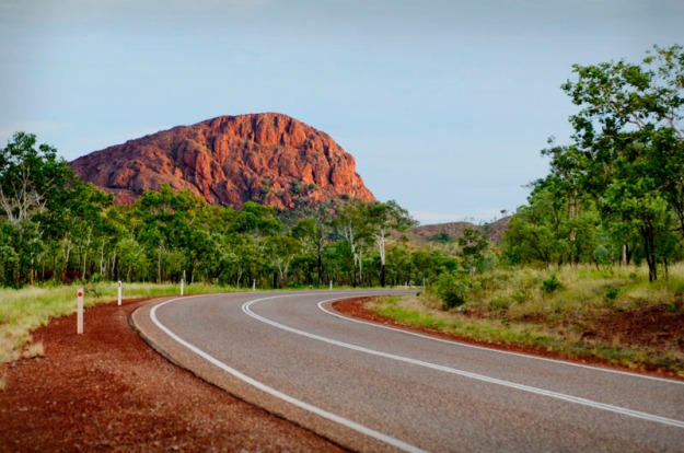
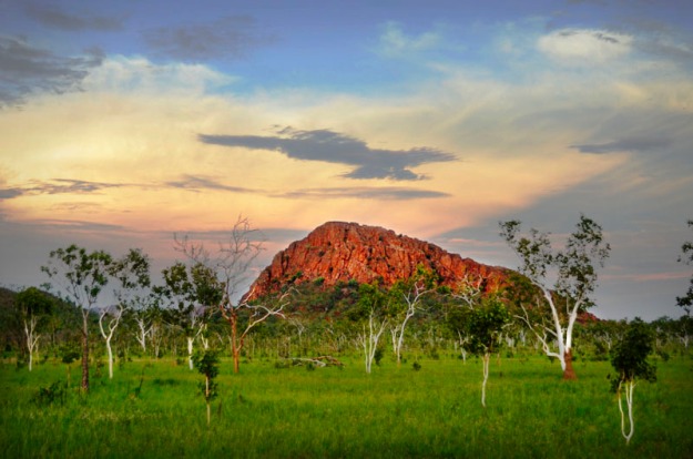
On passing through a cutting on the Great Northern Highway, this mountain appeared to my left, amidst the savannah plains at dusk.

The Kimberley is one of the world’s last remaining savannah wilderness regions. A savannah is a grassland ecosystem characterised by the trees being sufficiently widely spaced so that the canopy does not close. The open canopy allows sufficient light to reach the ground to support an unbroken herbaceous layer consisting primarily of grasses.

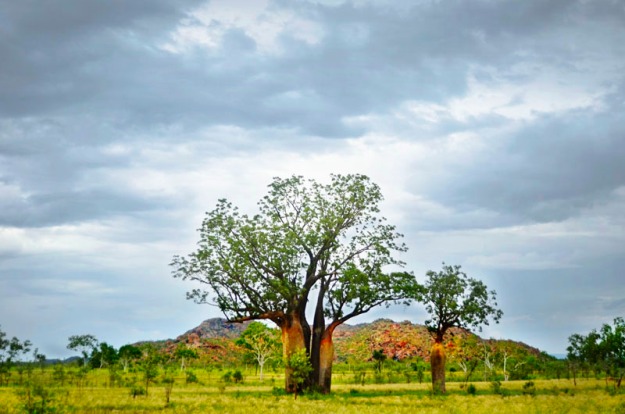
Boab Cluster

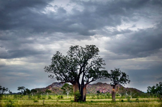
#12      Boab Cluster

Jan 4, 2013: 19:16

Latitude, Longitude: -16.69979, 128.252506

On the side of the highway about 200 km NE of Halls Creek this cluster of Boabs huddled together on the savannah before the distant range. I was so taken by this scene that I pulled off onto a roadside levee where I watched them under the setting sun before sleeping there for the night.

Paradise Once Lived Here

# 13     Paradise Once Lived Here

Dec 27, 2012

Latitude, Longitude: -15.77973, 128.740239

Industrial Facility, Kununurra, far NE Kimberley.

The Bastion

#14      The Bastion

Jan 1, 2013: 21:23

Latitude, Longitude: -15.450886, 128.11904

Looking towards the mouth of the Ord River at Cambridge Gulf, far NE Kimberley.

Morning Glory

#15      Morning Glory

Apr 8, 2013: 07:55

Latitude, Longitude: -17.500548, 122.145216

Morning Glory is traditionally used as a bush medicine, a bandage of the ground vine leaves being applied as a poultice. Sections of vine could also be rubbed, bent and bruised, and then tied around the head to relieve headaches and migraines.

I slept out here on the dunes (at Walmadan, the epicentre of the proposed Liquefied Natural Gas processing plant) for about five weeks, under a star-filled sky, sometimes with an Indian Ocean breeze rolling up the dunes to keep the mozzies at bay, sometimes with the breathless humid night air which left me dripping with sweat and made me a feast for the mozzies, and occasionally with a stormy inland easterly tearing at my covers.

…………………………………………….

And here the visual and literary trip ends. That’s all folks. Really hope you enjoyed the show and thanks to you all for your involvement, whether in person or virtually. The more we all get the message out there, bit by bit, the greater the chance to keep The Kimberley wild and free.

Personally, it’s been a massive, massive, massive experience and adventure which has spanned this amazing continent over several months and about ten thousand kilometres, and which has come full circle back to Melbourne where the original realisation that ‘I must go’ occurred nearly one year ago. I’ve learned a few things along the way about nature, humanity, culture…and myself. Hopefully I’ll remember some of the more profound personal lessons and stop falling down unnecessary rabbit-holes.

In closing, I’d like to send out a big thanks to: Elder and Law Boss, Phillip Roe and The Goolarabooloo Mob – traditional custodians of the Walmadan area; The Awesome Foundation for their funding support; Tom Montgomery – the awesome painter; The Bob Brown Foundation for providing Bob; Rathdowne Cellars for greatly discounted plonk.

I’d love to hear your thoughts so please leave a comment if you’d like to.

Thanks for listening and bye for now,

Hunter G

p.s. Keep The Kimberley always in your hearts and minds. The industrial invaders are just around the corner….but before they arrive…think about helping Save The Tarkine which is under immediate threat. The Tarkine is an area of immense natural beauty in NW Tasmania but, as with The Kimberley, it is also an area of immense mineral wealth – and the mining companies are on their way.

Sales:

All Hunter’s exhibition images are available for sale in the following formats:

A) 30 x 40 cm framed prints on metallic paper;

B) 120 x 84 cm unframed prints on 160 gsm matt paper;

C) Special 100 x 70 cm framed Limited Edition prints of ‘Iron Storm’ and ‘Electrical Storm’ on metallic paper (Edition limited to 5). NB. ‘Iron Storm’ and ‘Electrical Storm’ are also available at the other sizes as an open edition as listed in A) and B) above. Please contact Hunter on 0410 757 202 or leave a reply to this post.

Tom’s watercolours are also available for sale. Contact Tom via his blog.

Images and Text Copyright Hunter G, 2013 (except where noted) and available for sale.

English: Location of the Kimberley region in A...

English: Location of the Kimberley region in Australia. (Photo credit: Wikipedia)

James Price Point

James Price Point Area (Photo credit: Wikipedia)

Savage River Mine Pit, Tarkine

Savage River Mine Pit, Tarkine (Photo credit: Greens MPs)

Savage River

Savage River, Tarkine (Photo credit: -jell-)

tarkine

tarkine (Photo credit: howard61)

Looking towards Mt Lindsay and Parsons Hood, T...

Looking towards Mt Lindsay and Parsons Hood, Tarkine (Photo credit: Greens MPs)

Fungi detail, Mt Lindsay, Tarkine

Fungi detail, Mt Lindsay, Tarkine (Photo credit: Greens MPs)

Exhibition – ‘The Kimberley’ – May 21 to June 9

Barramundi & Iron-Ore Loading Yard.

Barramundi & Iron-Ore Loading Yard.

Breaking News!!!…The full series of exhibition images and accompanying text is now online here.

Or read on for the original promo post…

Hi folks,

from May 21 – June 9, Kimberley painter, Tom Montgomery, and I will hold an exhibition about the ongoing threat of industrialisation to the magnificent Kimberley region in NW Australia. Tom will be exhibiting watercolour paintings from the Walmadan area while I will be showing photographs from across The Kimberley. Please spread the word. All welcome.

The Kimberley – Australia’s Threatened Wilderness

When: May 21 – June 9

Where: St Heliers Gallery, Abbotsord Convent Arts Precinct, Melbourne

Opening Night: Fri May 24, 5 – 8 pm.

Official Closing Address: June 7 at 10.30 am. Come and hear Bob Brown (ex Greens Leader, ex Franklin River Campaigner, current Bob Brown Foundation creator, current Save The Tarkine Patron, and all round bloody awesome fella!) tell us why he thinks The Kimberley is so important. Thanks Bob.

Why: Despite Woodside canning its plans for the world’s largest LNG processing plant at Walmadan, WA Premier Barnett has declared he is continuing the compulsory acquisition process of the land around Walmadan. Industrial Invaders will keep coming in the months/years ahead. Keep Kimberley always in your hearts & minds.

There is too much priceless culture and wilderness to lose…millions of years of creation and 40,000 + years of Aboriginal culture…in exchange for a predicted 50 years of mining. Madness!

Here are some sample images of Tom’s incredibly detailed and beautiful watercolours:

Walmadan Cliffs

Walmadan Cliffs

Squirrel Fish

Squirrel Fish

Barramundi

Barramundi (detail)

Barramundi

Barramundi

Pelicans

Pelicans – symbol of the Goolarabooloo Aboriginal people

Shore Bird

Shore Bird

Owlface

Owl faced Finch

All of the above would’ve been severely affected/destroyed by Woodside’s/Barnett’s failed plan.

And here follow a few of Hunter’s pics:

Cliffs at Walmadan (James Price Point)

Cliffs at Walmadan (James Price Point), 2013

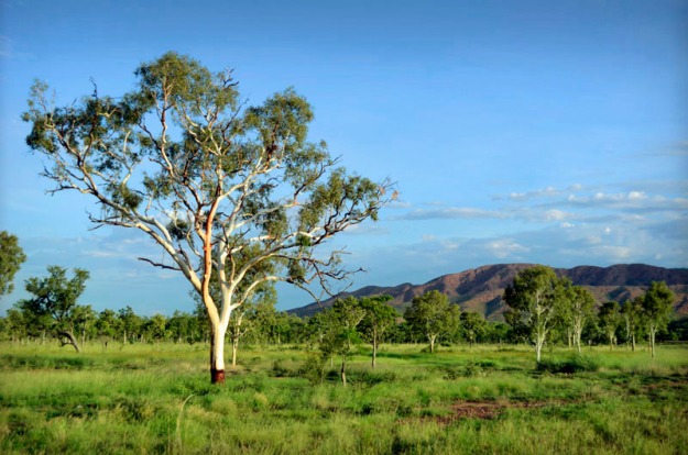
Savannah, Eucalypts & Mountain

Savannah, Eucalypts & Mountain, 2013

KMG's Iron-ore Loading Yard on sensitive mangrove and mudflat ecosystems. Cambridge Gulf, Wyndham

KMG’s Iron-ore Loading Yard on sensitive mangrove and mudflat ecosystems. Cambridge Gulf, Wyndham, 2013

Above, an example of inappropriate development…on a small scale – Kimberley Metals Group Iron-Ore loading yard on sensitive mudflats and mangroves at Cambridge Gulf. Signs around town warned people not to drive on the mudflats due to their sensitivity – but an iron-ore loading yard was somehow deemed OK!! If Barnett’s plan ever comes to fruition, we will see hundreds of large-scale mining projects across The Kimberley.

To get to and from the loading yard, the Kimberley Metals Group employs Hancocks transport to drive massive road trains (up to 53 metres long)  to/from their iron-ore mine site, Ridges Mine, located several hundred kilometres further inland. These road-trains pass in each direct EVERY 20 minutes for approximately 20 hours a day. Again, remember, this is relatively small scale – nothing compared to the plans Barnett has.

And below, overlooking Cambridge Gulf from The Five Rivers lookout, which was recently listed as one of the top ten lookouts in the world. And not to forget that the NY Times recently listed The Kimberley as one of the top must-see destinations in the world – they also noted the massive threat of industrialisation if it not protected soon. And yet the iron-ore loading yard went ahead, right at the base of this lookout. Crazy, frightening and a major warning of potential things to come if we don’t continue to act.

Storm over Cambridge Gulf, Wyndham, NYE 2012

Storm over Cambridge Gulf, Wyndham, New Years Eve, 2012

Tom and I really hope you can join us at the show. Please help spread the word.

Keep The Kimberley always in your hearts and minds.

Hunter G and Tom would like to sincerely thank the Goolarabooloo Aboriginal people, and in particular, Law Boss and Traditional Owner, Philip Roe.

Thanks for listening and bye for now,

Hunter G, Tom and Claude (the damn van – that was my house, home and transport for 5 months – thanks Claude, I’ll come back for you soon!)

Some Things I Saw – Part 3

And so we hit the road again, this time for the final leg to the West Coast and only 50 km south of the seriously threatened Walmadan (James Price Point), traditional country of the Goolarabooloo Jabbirr Jabbir peoples and the warrior, Walmadany, who once lived there.

Halls Creek (the beautiful, intriguing and tasty innards) to Broome (pearling mecca and home of The Pigram Brothers).

Great song which refers to Walmadan…

The Kimberley

The Kimberley

Once again before we depart, a warning as per previous Some Things I Saw posts – more pics below of beautiful, but deceased, animals.

Afternoon Storm and Sunrays I, Near Halls Creek

Afternoon Storm and Sunrays I, Near Halls Creek

Rocky Outcrop, near Halls Creek

Rocky Outcrop, near Halls Creek

Afternoon Storm and Sunrays II, Near Halls Creek

Afternoon Storm and Sunrays II, Near Halls Creek

White Man's Trash

White Man’s Trash

Who is Hunter G II

Who is Hunter G?

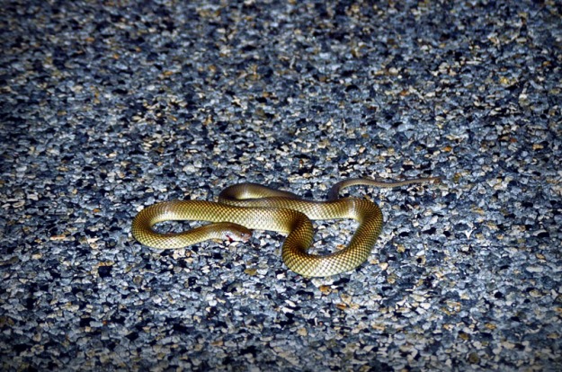
Road Victim, Injured Snake

Rather Annoyed Snake

The rather annoyed snake, above, had just been hit by a car and was bleeding from the side of its head. Helped it off the road with my tripod. And do ya think it was grateful? Not so much as a ‘thank you’. Just rearing and hissing. So I reversed over it before continuing on. Not.

Dawn, Rest Area near Halls Creek

Dawn, Rest Area at Numpan Hills

Numpan Hills I, near Halls Creek

Numpan Hills I, near Halls Creek

Beautiful colours and forms.

Numpan Hills II, near Halls Creek

Numpan Hills II, near Halls Creek

Numpan Hills III, near Halls Creek

Numpan Hills III, near Halls Creek

Numpan Hills IV, near Halls Creek

Numpan Hills IV, near Halls Creek

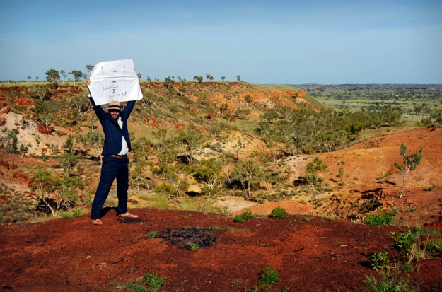
And here’s WA Premier, Colin Barnett, below, beer-bellied but hard at work plugging himself as usual and thinking dirty thoughts – “what’s in dem hills below? Will they make me immortal if I dig’emupandsell’em?”

Colin Hard at It - Numpan Hills, near Halls Creek

Colin Promoting his Personal Philosophy – ‘1 + 1 = Whatever The Hell I Want’. Numpan Hills, near Halls Creek

Road Kill Scar

Road Kill – scar of burned out car

Numpan Hills, near Halls Creek

Numpan Hills, near Halls Creek

Above, reminds me a little of Monument Valley, Utah, USA. Let the drooling begin, a la Homer Simpson. ‘Mmmmmmmmmmmmmmmmmmmmm…

Things that make Homer go ‘Mmmmmmmmm…

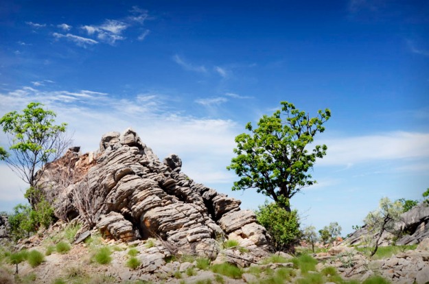
Below, Limestone country to the left, Sandstone country to the right.

Limestone & Sandstone, Numpan Hills

Limestone & Sandstone, Numpan Hills

Swimming, Fitzroy River, Fitzroy Crossing

Swimming, Fitzroy River, Fitzroy Crossing

Fitzroy River Patterns, Fitzroy Crossing

Fitzroy River Patterns a la Michael Leunig, Fitzroy Crossing

For some reason the above image reminds me of Michael Leunig cartoons….

Michael Leunig - Inner Duck

Michael Leunig – Inner Duck

And if you want a greater insight into the working’s of this great cartoonist, artist, philosopher’s mind, here’s an interview with Leunig by Margaret Throsby from ABC Classic FM (takes a while to load).

Kids Swimming, Fitzroy River, Fitzroy Crossing

Kids Swimming, Fitzroy River, Fitzroy Crossing

Raptor at Dusk, Fitzroy River, Fitzroy Crossing

Raptor at Dusk, Fitzroy River, Fitzroy Crossing

Net Fishing, Fitzroy River, Fitzroy Crossing

Net Fishing, Fitzroy River, Fitzroy Crossing

Geike Gorge National Park I, Fitzroy River, Fitzroy Crossing

Geike Gorge National Park I, Fitzroy River, Fitzroy Crossing

‘Mm, I think these are both weeds, above and below (Passion weed?). But beautiful nonetheless….and much safer than an invasion of Barnettus Colinus.

Geike Gorge National Park II, Fitzroy River, Fitzroy Crossing

Barnettus Colinus, below…

Barnetus Colinus - Invasive Species

Barnetus Colinus – Invasive Species

Don’t say I didn’t shoot a croc – you can see the snout, below, breaking the waterline just inside the tip of my high quality, giant red Croc. So there!

Achtung! Crocodile! Geike Gorge National Park IV, Fitzroy River, Fitzroy Crossing

Achtung! Crocodile! Geike Gorge National Park IV, Fitzroy River, Fitzroy Crossing

Geike Gorge National Park V, Fitzroy Crossing

Geike Gorge National Park V, Fitzroy Crossing

Damn fine wet season grass, above. And striking rocks, below.

Geike Gorge National Park VI, Fitzroy Crossing

Geike Gorge National Park VI, Fitzroy Crossing

Geike Gorge National Park VII, Fitzroy Crossing

Geike Gorge National Park VII, Fitzroy Crossing

Below – Damn it, just after I said to myself,  “Hunter, you said you’d be sensible on this road trip and focus on the main ‘Save The Kimberley’ objective. Stop following this dodgy road or you’ll end up bogged. Turn around.” So I did. And got bogged in the process!

Step One, below – dig a bit and throw some wood around…

Bogged I - Fitzroy Crossing

Bogged I – Fitzroy Crossing

Step Two, get in driver’s seat and drive…backwards probably best.

Bogged III - The Road Ahead, Fitzroy Crossing

Bogged II – The Road Ahead, Fitzroy Crossing

Step Three, below – fail! Show concern, then start again.

Bogged II - Fitzroy Crossing

Who is Hunter G? Bogged III – Fitzroy Crossing

Below – Starting again, this time with the assistance of the City of Melbourne.

Bogged IV - Authorised Vehicles Excepted, Fitzroy Crossing

Bogged IV – Authorised Vehicles Excepted, Fitzroy Crossing

But Failed Again!

Step Four – Give Up! Call RACV via RACWA, over to RACV back to RACWA back to RACV, over to Towie… wait for ages…but make the most of the Total Care you paid for…and get them to tow you all of 3 metres at a cost (to them) of about $180. Yep. Worth every penny despite the dent to my manliness. To mitigate my manly losses just keep in mind that I’m a newby in the tropics, it was about 40 degrees celcius, 70% humidity and I gave it a red hot go for a couple of hours.

Exhausted and filthy as a result of the misadventure, I decided to stay in official accommodation for the first time on the trip thus far and get myself cleaned up. I chose to stay at the top o’ the line, Tarunda Caravan Park where I met the supportive couple, below, at the shower block.

Lizard & Cicada

Lizard & Cicada

Infinitely better hangin’ out with them than the other close-encounter I had – a man in his fifty’s who hung outside his caravan IN HIS Y-FRONTS while listening to Neil Diamond‘s ‘Cracklin’ Rosie‘ for an extended period.

Cracklin Rosie…

In my humble opinion, y-fronts should be banned. However, if due to some vagary of personality you would in fact like to see more, I suggest you visit here for a general Y-front overview. Or here, here..and here for the good, the bad and the downright weird (respectively? I’m not saying. So be prepared!)

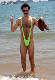
And here are two more of our favourites in their finest…

Homer, Tribal Man & Donut

Homer, Tribal Man & Donut

Borat in his Finest

Borat in his Finest

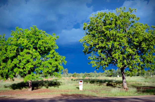
Rubbish Bin & Approaching Storm

Rubbish Bin & Approaching Storm

I love that bin. Yeah, that one, above.

Ahhhh, let the off-highway adventure begin. On the Leopold Road, heading towards Tunnel Creek and Windjana Gorge where the Aboriginal warrior, Jandamarra hid out during his brave attempts to repel the whitefella settlers.

Oscar Range, Leopold Road

Oscar Range, Leopold Road

Quarry, Leopold Road

Quarry, Leopold Road

So, there we were, Claude and I, driving along Leopold Road in the middle of beautiful wild nowhere when we rounded a bend and copped this obscenity (below) in the face. Suddenly, out of the remote blue, a billboard promoting Wesley fucking College private school from Melbourne. Only a private school sense of entitlement would result in this sort of advertising in the wilderness. Nowhere else did I see anything remotely like it. The only other signs around in this sort of terrain were humble signs noting one’s passing of such-and-such cattle station.

Sense of Entitlement - Wesley College Private School, Leopold Road

Sense of Entitlement – Wesley College Private School, Leopold Road

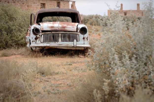
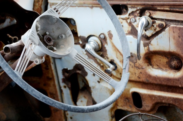
Abandoned Combi - Leopold Road

Abandoned Combi, with Nazi Swastika – Leopold Road

And then, drum roll, Claude’s and my first real test….

Approaching Bog - Leopold Road

Approaching Bog – Leopold Road

And then, Claude’s and my first MAJOR fail…

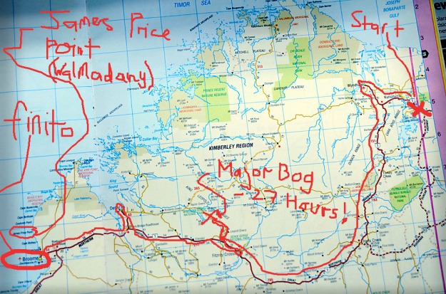
Bogged I - Leopold Road

Bogged I – Leopold Road

Damn it, I was so close. I’d tested the solidity of the ridges, picked the most suitable ones…and then simply misaligned the bloody wheels and slipped off the edge. Bugger! Bogged!…

Bogged II - Leopold Road

Bogged II – Leopold Road

… for TWENTY-SEVEN long, isolated yet mostly enjoyable hours!

Step One – I tried the obvious, below. A bit of the old rock wedging under and around.

Bogged III - LH Rear - Leopold Road

Bogged III – LH Rear – Leopold Road

Bogged IV - RH Rear - Leopold Road

Bogged IV – RH Rear – Leopold Road

Step Two – jump in the driver’s seat, look happy (too happy perhaps) and try to convince yourself and the Gods that all is OK! And drive!

Who is Hunter G? Bogged VI - Leopold Road

Who is Hunter G? Bogged VI – Leopold Road

But fail. All was not OK. And, once again, it was about 40 degrees celcius.

Step Three – Begin again. In an attempt to reverse the near-25-degree tilt that Claude ended up on when we first got bogged I whacked the jack under the back LEFT wheel and jacked away, expecting weight to be shifted to the RHS. But what’d we end up with? This…

Bogged VI - RH Rear - Leopold Road

Bogged VI – RH Rear – Leopold Road

Yep, the left wheel went nowhere but the right one headed further skyward, instead of earthward as I had predicted. Weird and uncanny. But more likely that the high school physics recollections that I employed were way off track.

Step Four – But at least it meant I could jam a shiteload more rocks under the rear RHS wheel which had previously been spinning like a top. But unfortunately I didn’t notice the small sharp edge on one of dem rocks that resulted in part of the tyre being shredded when I next tried to drive away.

And so, NEXT IDEA…

Step Five – Tried again to level Claude, this time by jacking the front LH wheel up while digging a dirty big hole for Front RHS Wheel. Yay! This worked – eventually the jacking and digging led to a collapse and levelling.

Bogged VII - RH Front - Leopold Road

Bogged VII – RH Front – Leopold Road

I then left the jack in place with the intention of eventually driving straight off the top of it. Unorthodox? Perhaps. But before that could happen I decided it’d be necessary to go the whole hog’ and re-sculpt the road ahead, cutting away high bits to fill in the lower boggy bits.

Bogged VIII - LH Front - Leopold Road

Bogged VIII – LH Front – Leopold Road

Obviously at this point (god knows when exactly) I grew tired of documenting things for you folks so this is where the visual journey ends. I was prepared for up to about a five day wait while slowly working on various de-bogging options. And if five days did roll around and I was still bogged, the vague plan was to carry as much water as possible and walk back out to the highway, a distance of about 50 km, over two nights, knowing that there were at least a couple of creek crossings along the way.

At some point, one day turned into another – ah, yes, that occurred before the leveling because I remember trying to sleep in Claude on a 25 degree angle and continually rolling into the lower wall, readjusting…and then rolling again into the lower wall, and so on and so on. The following day, during my heat-o’ the day nap’ when I’d downed tools to stop from dying of heat exhaustion, I had a vision….

…not of the holy Brahmin bull below (fine specimen though he is), but of two humans approaching slowly. In my dazed state, they may have been Adam and Eve (but then, who would’ve I been?).

Adam and Eve - Victor Brauner, 1923

Adam and Eve – Victor Brauner, 1923

In fact they were Mike and Trudy, heading out on a hot date to Tunnel Creek. But instead of romance they found themselves wondering whether they had just found a dead man lying in the back of his Toyota TOWN Ace (‘mmm, perhaps Claude’s ‘make and model’ should’ve alerted me to the dangers of 4wd’ing in a bloody TOWN Ace!!!). Anyway, Mike and Trudy thought I was dead. But in the third minute I awoke, dazed and, yes, you guessed it, confused…at least for 60 seconds or so as I rolled over, looked up at the vision, clumsily extracted myself from Claude’s innards and groggily walked towards them. After the surrealist vision wore off I realised I was in good hands. Not God’s hands. Good hands. Real live hands. My time was up.

Brahmin Bull, Leopold Road

Brahmin Bull, Leopold Road

And to cut an already long story a little short, they towed me out and I returned whence I came, successfully rejecting the inner voice telling me to venture on.

I returned to Fitzroy Crossing, but not as far as Tarunda Caravan Park and the man in his Y-fronts. Oh no, not that far back, that was for sure. I had already suffered enough. Never get out of the caravan. Whatever you do, never get out of the caravan…in your fucking Y-fronts, no matter who the hell you think you are or what funky Neil Diamond track you might be listening to. Just don’t do it!

A tenuous link. Because I can…

“Never get out of the Boat”

And continuing in the vaguely related gruesome vein of Apocalypse Now, I offer thee…

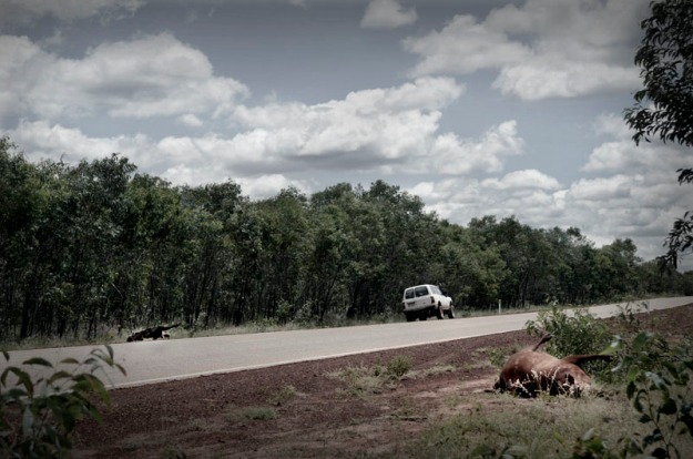
A white landcruiser, A cow and A bull. Switch off now if you are sensitive to death.

The landcruiser had managed to take out two large beasts, leaving everyone in very bad shape: two dead beasts, a written off car and an unknown final outcome for passengers, although hair caught in the cracks of head-butted, crazy-paved windscreen didn’t imply a fun experience.

Road Kill, Bull

Road Kill, Bull

Road Kill, Cow

Road Kill, Cow

Road Kill Trio

Road Kill Trio

Another darkly beautiful scene – Phantom of the Operatic Outback…

Road Kill, Cow III

Road Kill, Cow III

Road Kill, Cow II

Road Kill, Cow II

Road Kill, Cow I

Road Kill, Cow I

But things always lighten up again at some stage, even though a storm always lurks in the distance…

Cumulus Nimbus II, Fitzroy Crossing

Cumulus Nimbus II, Fitzroy Crossing

Cumulus Nimbus I, Fitzroy Crossing

Cumulus Nimbus I, Fitzroy Crossing

And so I returned once again to Fitzroy Crossing……and a welcoming party of two daredevil dogs that made every car, truck and even road-train run the gauntlet.

Dog Rage I, Fitzroy Crossing

Dog Rage I, Fitzroy Crossing

Dog Rage II, Fitzroy Crossing

Dog Rage II, Fitzroy Crossing

Dog Rage III, Fitzroy Crossing

Dog Rage III, Fitzroy Crossing

After a quick refuel Claude and I left town again that evening, bound for Derby, about 250 kms NE of Broome. I was finally getting close. Close to the west coast.

Soon after leaving Fitzroy Crossing, we were presented with an inspiring electrical storm in the distance ahead. Here are some abstract sort-of-shit-sort-of-interesting-thru-the-windscreen-while-driving shots of the action. Sort of depends on who’s viewing and/or what substances have been imbibed/injected. Over to you…

Storm over Highway III

Storm over Highway III

Storm over Highway II

Storm over Highway II

Storm over Highway IV

Storm over Highway IV

Storm over Highway I

Storm over Highway I

Storm over Highway V

Storm over Highway V

A painfully beautiful aside…

'Lightning Flower' - Image from ArmageddonOnline

‘Lightning Flower’ – Image from Armageddon Online

Above, the resulting scarring from a lightning strike.

Claude and I arrived in Derby ’round midnight, and chose the wetlands on the edge of town as our home for the next few nights.

Termite Mound and Boab

Termite Mound and Boab

Bee with Pollen, Derby Wetlands

Bee with Pollen, Derby Wetlands

Derby Wetlands II

Derby Wetlands II

Malformed Flying Formation

Malformed Flying Formation

Derby Wetlands I

Derby Wetlands I

The Boab Prison Tree on the outskirts of town – a dark history for a beautiful tree estimated to be 1500 years old:

The Boab Prison Tree IV, Derby

The Boab Prison Tree IV, Derby

Before Derby was established in1883, Aboriginal people were kidnapped. The kidnappers, known as blackbirders, were settlers connected with the pearling industry. They wanted divers and workers for the boats. They rounded people up and put them in chains and held them at the Boab Prison Tree while they waited for a boat. Later prisoners were held here awaiting trial in Derby.

The Boab Prison Tree I, Derby

The Boab Prison Tree I, Derby

The Boab Prison Tree II, Derby

The Boab Prison Tree II, Derby – Graffiti

The Boab Prison Tree III, Derby

The Boab Prison Tree III, Derby

Back in town I came across this funky propeller-gum combo. The propeller, from the sunken cargo ship S.S. Colac, was installed in 1964 and has been gradually engulfed by this adventurous eucalyptus.

Human Nature III, Derby

Human Nature III, Derby

Human Nature II, Derby

Human Nature II, Derby

Human Nature I, Derby

Human Nature I, Derby

Petroleum, Eucalyptus & Boab

Petroleum, Eucalyptus & Boab

The last known substantial population of the endangered Freshwater Sawfish lives here in the Fitzroy River. Another reason why mining The Kimberley makes such amazing sense.

Freshwater Sawfish, Wyndham

Freshwater Sawfish, Wyndham

Car Tracks at Sunset, Wyndham

Car Tracks at Sunset, Derby

And then it was back on the road for the last leg: Derby – Broome.

Fitzroy River

Fitzroy River, further downstream from Fitzroy Crossing

White Man's Trash I

White Man’s Trash I

White Man's Trash II

White Man’s Trash II

Ski Lake

Ski Lake

Ski Lake Patterns II

Ski Lake Patterns II

White Man's Trash I

White Man’s Trash – bottle

Ski Lake Patterns I

Ski Lake Patterns I

Termite Field

Termite Field

Termite Mound

Termite Mound

And finally, after 8410 massive and mostly enjoyable kilometres, I rolled up to Minyirr (Gantheume Pt) at sunset. My coast to coast odyssey was over… but I still had 60-odd km to travel by road before I reached Walmadan, the sacred yet seriously threatened site where WA Premier, Colin Barnett, desperately hopes to build the world’s largest Liquefied Natural Gas processing plant.

If successful, the LNG gas plant will be the beginning of the end for the world-renowned Kimberley region, one of the last remaining wilderness regions of its type in the world. And one which is extremely rich in cultural history. It would be an incredible, irreversible tragedy to lose all of this. Yet despite cheaper and more environmentally/culturally appropriate alternatives (pre-existing infrastructure in The Pilbara would be $15 B cheaper OR using new foating LNG technology would be $9 B cheaper) Barnett is adamant that the plant must be built at Walmadan. The real reason for his obsessive and irrational determination is his extremely dangerous ego which hopes to see his name go down in history as having burst open and industrialised the entire Kimberley to greedily and short-sightedly gorge on its buried wealth. A sickening thought.

Lighthouse at Gantheume Point

Lighthouse at Gantheume Point

The pindan at Minyirr, below, was rich underfoot and in striking contrast to the cyan sea and faded yellow-orange sky.

Gantheume Point (Minyirr) IV, Broome

Gantheume Point (Minyirr) IV, Broome

Lurujarri Heritage Trail, Minyirr

Lurujarri Heritage Trail, Minyirr

The Lurujarri Heritage Trail, above, follows part of a sacred songline which runs along the Dampier Peninsula through the currently threatened site of Walmadan (James Price Point). The trail, beginning here and ending 82 kilometres north, was set up by Aboriginal Elder, Paddy Roe (recipient of an Order of Australia medal) in a generous and intelligent attempt to bring two very different cultures together in the interests of shared knowledge, greater understanding and furthering reconciliation. But this is  to be destroyed if Barnett’s vision for Walmadan succeeds. Walmadan, the trail and the songline (a continuous path which cannot exist in separate physical parts) will be destroyed – an horrific legacy of an egomaniac.

Gantheume Point (Minyirr) III, Broome

Gantheume Point (Minyirr) III, Broome

Gantheume Point (Minyirr) II, Broome

Gantheume Point (Minyirr) II, Broome. Cable Beach in the Distance.

Gantheume Point (Minyirr) I, Broome

Anvil, Gantheume Point (Minyirr) I, Broome

Do what you can. Thanks for listening and bye for now,

Hunter G

ps At this stage the best thing one can do to help would be to write to Federal Minister for the Environment, Tony Burke, who still has to give his approval for the project to go ahead. Visit the following links for letter writing tips and other ideas too.

pps. Interesting fact…Did you know that Hunter G just received a grant to help with production of his Save The Kimberley exhibition which will open in Melbourne in May (details to come)? He will be exhibiting with Kimberley painter, Tom Montgomery. Thanks to the Awesome Foundation for their grant.

Now for those links:

Broome Community’s ‘No Gas’ Website

Environs Kimberley

Wilderness Society’s Kimberley Link

Images and Text Copyright Hunter G, 2013 (except where noted) and available for sale (FREE for not-for-profit activities – just include a link to this blog). All profits from sales will be re-invested in Save The Kimberley activities.

Some Things I Saw – Part 2

…and away we go again. Some more things I saw.

Wyndham, The Kimberley’s northern-most town, to Halls Creek, the beautiful, intriguing and tasty innards …

Wyndham to Halls Creek

Wyndham to Halls Creek

Above – the section from Wyndham to Halls Creek. Below – the overall Kimberley Region.

The Kimberley

The Kimberley

nb. ‘bog’, as in car being bogged. just thought i better clarify.

And a quick word of warning again, as per the Some Things I Saw Part 1 post – more pics below of beautiful, but deceased, animals.

But not this first pic. Here we have a real live crocodilus from Wyndham. Truly ruly! But with what look like flippers instead of feet – oh well, minor flaw.

THE BIG CROC!!!!

THE BIG CROC!!!!

Ah, yes, there it is – THE BIG CROC. How we all love a BIG whatever (why am I not surprised that Queensland seems to have the greatest quantity?) Soon, if we’re not really determined, we’ll find ourselves with THE BIG LIQUEFIED NATURAL GAS PROCESSING PLANT near Broome. And we could all come and take souvenir pics of ourselves, dwarfed by…..THIS…

…the proposed gas hub overlaid on a map of Perth.

Proposed Gas Hub Overlaid On Perth

Proposed Gas Hub Overlaid On Perth

…Or…equivalent to 21 times the size of Melbourne’s CBD!

In a wilderness zone (with sacred sites and a living aboriginal culture also), that is madness and completely disrespectful, in my humble (or not) opinion. But Colin (a.k.a. The Big Croc…of shite) likes to say the proposed plant is simply like a Big Fridge – ABC’s ‘Q & A’ a couple of months ago – Read Transcript/Watch Episode

A Big Fridge

A Big Fridge – Pic by Coinneach Shanks (check out his interesting blog here)

Personally, my primary reason for coming to help save The Kimberley is based on a long-term view and also on my sense of deep connection with wild natural landscapes – a connection which I believe all humans could experience if they allow themselves the required time and mental perspective. So we need to safeguard these wild/natural areas from the exploitative human hand. If the current Woodside/WA State Government proposal goes ahead it is my firm belief that the entire Kimberley region will be irreversibly devastated within three decades due to reasons discussed in previous posts and below.

Very recently a NY Times story listed The Kimberley as one of the world’s top 46 destinations for 2013 but also noted the threat to the region from mining. ‘Colin the Croc’, however, likes to look at things from a simplistic and narrow-minded perspective in a cynical attempt to mislead the public. The Croc’s response to the NY Times story was to say that the proposed site at Walmadany (James Price Point) “is a tiny area of the Kimberley – if the Kimberley was the MCG then James Price Point would be one seat.” Thanks Colin for your profound and enlightening commentary which, as a sports-obsessed-ausssie, I can easily relate to. Fortunately The Wilderness Society’s WA State Coordinator, Peter Robertson, in turn commented, “Barnett’s attempt to downplay the threat of industrialisation across the region is deeply misleading.”

Read the wilderness society’s comments…in response to Colin’s comments…..in response to the NY Times comments.

With respect to physical size, Colin may be correct with his MCG comparison (I’m not sure, I haven’t done the maths) but it takes no account of the long-term effects OR the immediate devastating effects on society/culture in the affected region AND simply ignores the environmental effects, implying it would be ok to destroy endangered monsoon vine thicket, threaten whale breeding grounds, etc, etc, etc.

Whilst I am also aware and concerned about the impacts of mining and industrial activity on the social, cultural and spiritual fabric of the region, my primary drive is environmental, although I imagine the ‘connection’ of which I spoke above could well be described as spiritual. I certainly have had other-worldly experiences in wild places, particularly in The Kimberley and Tasmania’s highlands where I have FELT a profound sense of calm, peace, wonder and belonging. It’s my hope that current and future generations will also be able to experience this and help us change our attitudes to the environment, to ourselves and to how we want our society to operate. With respect to society and culture, I certainly don’t seem to experience the same depth of connection, not yet anyway. Perhaps this will happen in time.

From a photographic perspective, my personal experience with The Kimberley environment is partly why there are virtually no humans in my photographs thus far, including no pictures of Aboriginal people whose ancestors lived here for such an incredibly long time in relative harmony with nature. With respect to Aboriginal people, I do not know anywhere near enough about their complex culture to fairly comment on or document them and their traditional connection to land. In time, as I very very slowly interpret and absorb the complexities of Aboriginal culture, (including a way of thinking that is very different to Western thought) hopefully I will come to understand it more fully and feel it is appropriate to comment/document. If I was to do so at this point I still feel I would be unfairly and unethically objectifying them.

(An aside…Ok, I realise this is currently more ‘Some Things I Thought’ rather than ‘Some Things I Saw’ but I promise there are a heap of cool pics coming soon down below.)

However,  someone who is well qualified to comment on these things is Jeanne Brown, a very well respected woman who has worked with the Aboriginal custodians and the environment over the past twenty-odd years, with particular experience learning about the region which includes the proposed site for the LNG processing plant.

I highly recommend you read a letter from Jeanne to the WA Minister for Indigenous Affairs, Peter Collier. I have copied it to my FB page – go to the Jan 24 entry headed ‘Jeanné Browne’s letter re S18 Approval’. In it, she comments in detail from an environmental and aboriginal heritage perspective, about the destruction and desecration that will occur if the recent S18 approval is not overturned. (Section 18 of the Aboriginal Heritage Act 1972, when approved, gives permission to the applicant, in this case Woodside Petroleum, to disturb/destroy areas that are covered by the Act.) You can read an article about the Broome community’s response to this approval here in The Australian. And if you wish to add your voice please sign the current petition to Minister Burke (Fed Minister for the Environment) who has the power to reverse the decision.

From Jeanne’s letter we can get an understanding of how, if this ruling is not overturned, it will destroy a previously unbroken Songline that passes directly through the proposed site. The proposed site at Walmadany (James Price Point) is about halfway along the Lurujarri Trail, a trail following the songline and opened to non-Aboriginal people 20-odd years ago by elder Paddy Roe, now deceased, who became an Order of Australia Medal recipient in 1990. It was Paddy’s vision to share his culture and heritage with non-Aboriginals in a genuine attempt to foster greater understanding and reconciliation between two very different cultures. Thousands of non-Aboriginal folk have now walked this trail.  NB. there are many ancestral graves in these dunes where Woodside has just been given permission for ‘exploration’. Can you imagine a company being given permission to destroy a revered Anglo-Australian’s grave such as war hero Weary Dunlop, Governer-General Bill Hayden (nb. not yet dead – sorry Bill), who awarded Paddy his OAM, or sporting hero Don Bradman?

Check out a short movie of ‘The Don’s’ Last Innings’ Is Don, Is Good (well, maybe not in this innings)

And here we have a short slideshow of Sir Weary’s local haunts set to uber cool old skool music.

Ok, less words from here on in, I promise.

———————————–

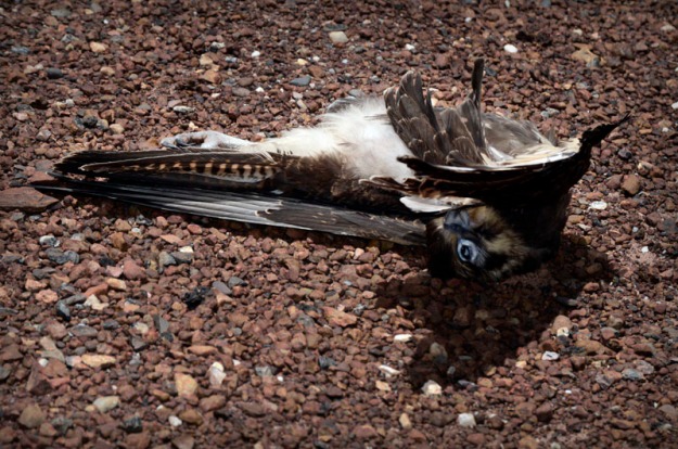
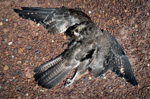
I found this lovely but dead raptor on the highway between Wyndham and the junction of The Great Northern and Victoria Highways – just near The Grotto where we saw Colin undertaking one of his estate sell-offs in Some Things I Saw – Part 1.

Road Kill, Raptor I

Road Kill, Raptor I

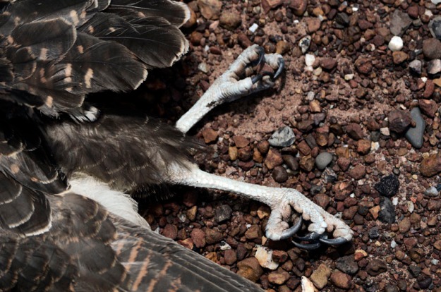
Road Kill, Raptor II

Road Kill, Raptor II

Road Kill, Raptor III

Road Kill, Raptor III

And another victim lays below. He was as dry as dry could be and I was very tempted to give ‘im a ride to replace the emu left behind at the quarantine checkpoint. Alas, I went on without him – his breath still had a slight ‘parfum de mort’.

Road Kill, Frog

Road Kill, Frog – or was it a toad?

If we let the Woodside proposal go ahead we open the floodgates to full-scale industrialisation of The Kimberley over the coming decades and we’ll be reducing the safe haven for native animals. Currently there are “NO recorded mammal extinctions in the north Kimberley” – source, Kimberley Coast.

Siamese Boabs

Siamese Boabs

Boabs – related to the Madagascan and African species known as Baobabs. The Australian species (Adansonia gregorii) is believed to have washed to our shores from Madagascar. You can find more info here and some great pics here.

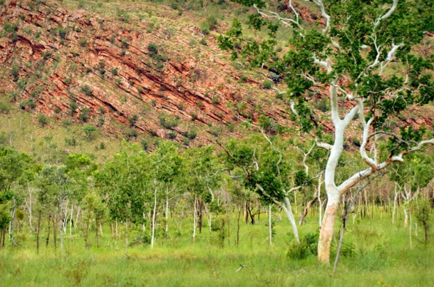
Eucalypt and Mountain

Eucalypt and Mountain

The greeny-yellow grasses, above, are prolific at this time of year.

Pandanus Gathering

Pandanus Gathering

I LOVE PANDANUS – always have, always will. Eucalypts are damn fine too. In fact, if I had to choose, it’d be eucys all the way, especially ghost gums that seem to glow in the dark.

Gum and Mountain

Gum and Mountain

Highway and Mountain

Highway and Mountain

It’s great to have this road through the terrain. But there are already enough of these to satisy us ALL for a lifetime. Open Kim up to mining in a grand scale and we’ll dissect her with mining roads and others that stem from the flow-on demands of a new population of mining workers, etc (plus there’ll be more roadhouses, more supermarkets, more department stores, more, more, more…)

Bush Track

Bush Track

Highway Cutting at Dusk

Highway Cutting at Dusk

Red Road

Red Road

Ooooooooh, now this mountain, below, looks like it’s full of something USEFUL.

Mountain at Dusk

Mountain at Dusk

Passing

Passing

Oncoming

Oncoming

Yes, the mining and exploration companies will think all their Christmases have come at once if the JPP (Walmadany) project goes ahead. If it does, the associated port will provide an invaluable export point, offering massive capital cost savings for potentially dozens of other companies which are interested to cut up Kimberley.

All Your Christmases

All Your Christmases

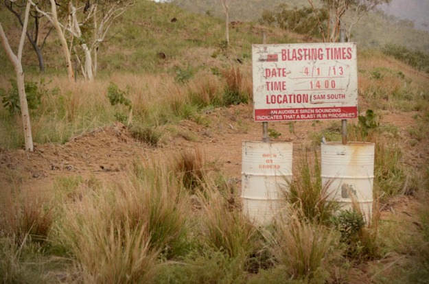
Kimberley Metals Group’s ‘Ridge Mine’, below, is the source point for the ore we saw at the loading yard in Wyndham.

No Entry - KMG's Ridge Mine

No Entry – KMG’s Ridge Mine

Dust covers the area for kilometres around and follows the roadtrains wherever they go.

Blasting Times - KMG's Ridge Mine

Blasting Times – KMG’s Ridge Mine – ‘Mmmm, how peaceful

Rubble - KMG's Ridge Mine

Rubble – KMG’s Ridge Mine

Dead Tree I - KMG's Ridge Mine

Dead Tree I – KMG’s Ridge Mine

And here, at the turn-off from the main highway to the mine a few kilometres away, I came across three conspicuously dead trees close to the above area which appears to have been cleared for some reason.

Dead Tree II - KMG's Ridge Mine

Dead Tree II – KMG’s Ridge Mine

Dead Tree III - KMG's Ridge Mine

Dead Tree III – KMG’s Ridge Mine

Or instead, we could choose to retain the following…

Flora I

Flora I

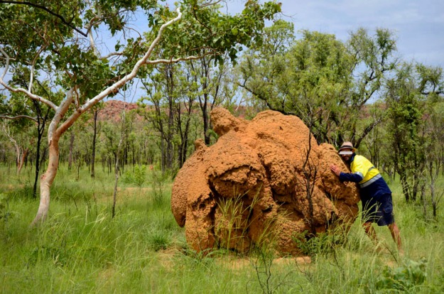
Hunter G and his Pet Mound

Hunter G and his Pet Mound

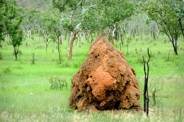
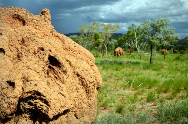
TERMITES!!! You Funky Fellas! What a damn fine effort.

Termite Mound

Termite Mound

Termite Mound - Interior

Termite Mound – Interior

And here’s David with a few words to say about termites…

…and now back on the human highway again…

Jailhouse Creek I

Jailhouse Creek I

Jailhouse Creek II

Jailhouse Creek II

And now we arrive at one of the WA Main Roads’ STOCKPILES, left for our enjoyment at random roadside locations.

Stockpile

Stockpile

‘Mmmmm, Rockpile Dreaming…

Rock Pile Dreaming

Rock Pile Dreaming

And Colin Cries, “Oh, Yes…This, all This!”, like a little boy with building blocks. Let’s please take Colin’s building blocks away before he breaks an ecosystem, a songline, a community (too late for the last one – Broome’s already divided).

And Colin Cries, "Oh, Yes...This, all This!"

And Colin Cries, “Oh, Yes…This, all This!”

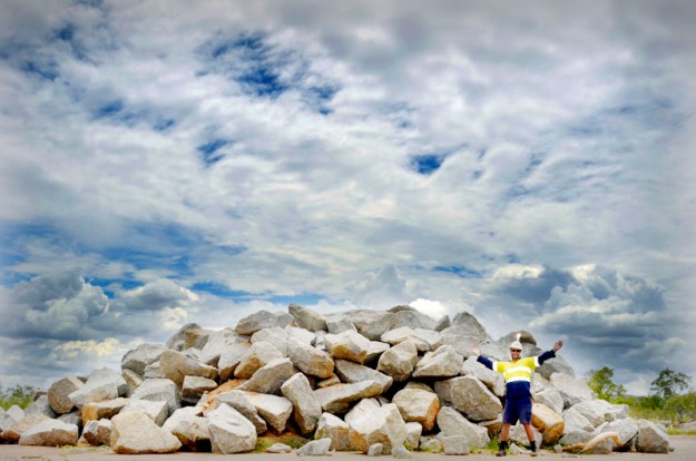
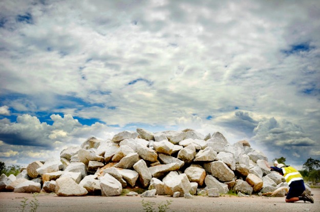
Bowing at the foot of THE PILE!…

Prayer Time

Prayer Time

Dirt Pile Dreaming

Dirt Pile Dreaming

44 Gallon Dreaming I

44 Gallon Dreaming I

44 Gallon Dreaming II

44 Gallon Dreaming II

Nature Strikes Back

Nature Strikes Back

I'm a '-?-?-?-?' and I'm '-?-?-?-?' (fill in your own words) - sung to the tune of 'I'm a Lumberjack and I'm OK'

I’m a ‘-?-?-?-?’ and I’m ‘-?-?-?-?’ (fill in your own words) – sung to the tune of ‘I’m a Lumberjack and I’m OK’

Bright Ideas Man

Bright Ideas Man

Colin and his Pet Rock – the 2-tonner

Colin and his Pet Rock – the 2-tonner

An aside, can I just say that I, um, I mean Colin, nearly died for those photo-shoots – it was forty-plus degrees in the shade in the middle of the day and we spent at least an hour shooting. “Good. Good. Good. You look Good, Colin. That’s Great Colin. Oh Colin, Yeah!” He lovvvvvved it!

…Or we could dump Colin and his building blocks A.S.A.P. (NB. WA State election this March 9) and keep more of this instead…

Trunks, Grass and Quartz

Trunks, Grass and Quartz

Flora III

Flora III

Boab Leaf

Boab Leaf

Flora II

Flora II

Wish I knew the names of some of these plants and grasses (the above one had a bit of a sage-style look about it – anyone? anyone?….Buell…)

I think this one below is a Spinifex grass….

Wet Season Grass

Wet Season Grass

Two Trunks I

Two Trunks I

Two Trunks II

Two Trunks II

Two Trunks III

Two Trunks III

Ohhhhhh, Yeeeeaaahhhhhh! Termite Mounds, YOU ABSOLUTELY ROCK!!!!!….

Termite Mounds

Termite Mounds

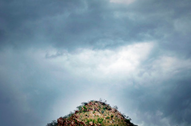
But see that rock up there? Yeah, the one that looks really cool atop the ridge and which probably has Aboriginal significance. TEAR IT DOWN and BUST IT OPEN would ya?! It’s gotta have something useful inside,… like a ‘kinder surprise’ – maybe there’s another building block for Colin inside!

Eagle Rock

That Rock Up There

That Rock Up There - Tear It Down! Termite Mounds and Mountains

That Rock Up There – Tear It Down! Termite Mounds and Mountains

Or, we could…just leave it be, like…

Hilltop Tree

Hilltop Tree

Hilltop I

Hilltop I

Hilltop II

Hilltop II

Boab Cluster

Boab Cluster

Boabs

Boabs

Boab Bark

Boab Bark

Boabs and Mountains

Boabs and Mountains

The preceding series of Boab shots was taken at the single cluster of four Boabs, above, growing as if one. ….with a littl’un off to the side, also.

Rain and Tree

Rain and Tree

Sunrise - 200 km NE of Halls Creek

Sunrise – 200 km NE of Halls Creek

The night before ‘Sunrise’, above, Santa reigned over the mountains, not wanting to give up his festive robes just yet…

Santa's Farewell II, 200 km NE of Halls Creek

Santa’s Farewell II, 200 km NE of Halls Creek

Santa's Farewell I, 200 km NE of Halls Creek

Santa’s Farewell I, 200 km NE of Halls Creek

Roadtrain V Claude I

Roadtrain v Claude I

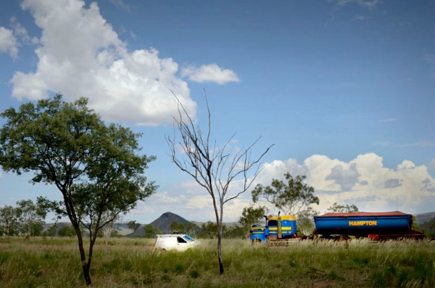
Claude, above and below, taking it both ways from Hampton’s iron-ore roadtrains, seconds apart. I’d only left him for a second. Brave Claude.

Roadtrain V Claude II

Roadtrain v Claude II

Mistake Creek

Mistake Creek

I believe there may be some dark, dark history associated with Mistake Creek, which is why I pulled up to shoot it. Let me just go to the record books. Bear with me…

Ah, yes, listed here as occurring in 1915, this dark list of massacres of Aboriginals.

Road Kill – Bird

Road Kill – Bird

Damn it I loved that bird (Rainbow Bee-eater). And it was my fault too. Unless you count the fact that she flew straight into Claude, in his natural habitat (a bitumen road). But God Damn she’s beautiful.

Claude’s and my personal road-kill tally at the 8410 km mark (after arriving at Broome) stands at:

1 x rabbit (cute, but no real loss in my book); 1 x bird, above.

And in the ‘Definitely Not Dead But Definitely Dazed and Confused’ category: 2 x birds (glancing blows); 1 x funky, funky, funky snake (flexible bugger). Both went on to bigger and better things.

Remnants of Commemorative Plaque - Jarlalu Bridge

Remnants of Commemorative Plaque – Jarlalu Bridge

At Jarlalu Bridge, above, someone had souvenired the commemorative ‘Aussie Aussie Aussie Oi Oi Oi’ Australia plaques but left a lovely little conglomerate inlay set in an adhesive, with just a dash of blue, AND A SHITLOAD OF CONCRETE ALL AROUND! Noice! Very Noice!

But even better, check out what we’ve got leftover below…

White Man's Trash at Jarlalu Bridge

White Man’s Trash at Jarlalu Bridge

Stairway to Nowhere – how inspiring and avante-garde. Oh, darling, we MUST have it. We can put it alongside the stuffed saltwater-infused crocodile to show man’s evolution …from damn fine fearsome crocodile creature (that yes, is capable of making top-notch hand-bags) to ‘let’s-make-everything-based-on-a-grid-system-so-that-life-is-oh-that-much-more-predictable’.

And just because I can…let’s tune in to a much much more creative stairway…

STAIRWAY TO HEAVEN – the music, the clothes, the hair, the lyrics: CRE-A-TIV-ITY!

Ohhhhhhhhhh, Yeah. Wait, just let me pick myself up off the floor after my air-guitar session. ….. Right, that’s gotta be one of the best song build-ups and guitar pieces in history. But getting back to Kimberley, I’m pretty sure I prefer my stone and layout like this…

Stone formations at Jarlalu Bridge

Stone formations at Jarlalu Bridge

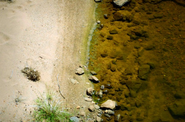
Watercourse at Jarlalu Bridge III

Watercourse at Jarlalu Bridge III

River Branches II

River Branches II

River Branches I

River Branches I

Sand, Stone, Water - At Jarlalu Bridge

Sand, Stone, Water – At Jarlalu Bridge

Watercourse at Jarlalu Bridge II

Watercourse at Jarlalu Bridge II

River Branches III

River Branches III

Watercourse at Jarlalu Bridge I

Watercourse at Jarlalu Bridge I

The raptors (Kite’s I think), above, had been feasting on a cow carcass in the riverbed until I disturbed them, whereupon they all went and sat happily together (but waiting fro me to piss off).

I also managed to scare the cows from their relaxed resting place under the tree, below, where they were all sprawled out doin’ nuttin’…

Wandering Cattle

Wandering Cattle

Highway and Storm Clouds

Highway and Storm Clouds

‘Mmmm, beautiful sweeping highway under a stormy sky…leading to this…

Fuck Off, I'm Full! ...Road Kill, Lizard I

Fuck Off, I’m Full! …Road Kill, Lizard I

Road Kill, Lizard II

Oh, Go On, Somebody Help Me Up…Road Kill, Lizard II

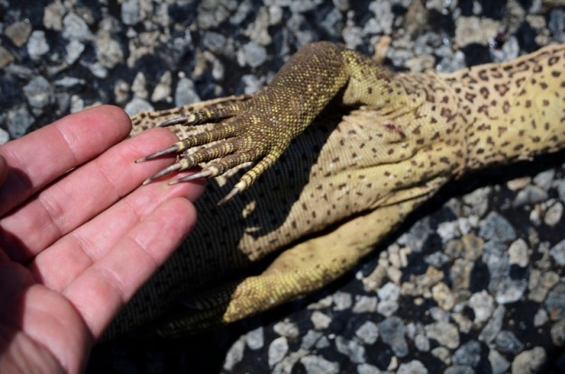
Hand to Hand - Road Kill, Lizard III

Hand to Hand – Road Kill, Lizard III

Red Dragonfly

Red Dragonfly

Names for the above/below – Anyone? Anyone?… Buel…

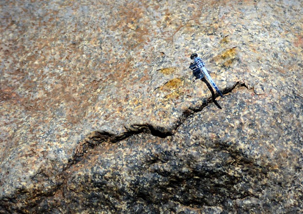
Blue-grey Dragonfly

Blue-grey Dragonfly

Funky Trunk, Caroline Pool, Halls Creek

Funky Trunk, Caroline Pool, Halls Creek

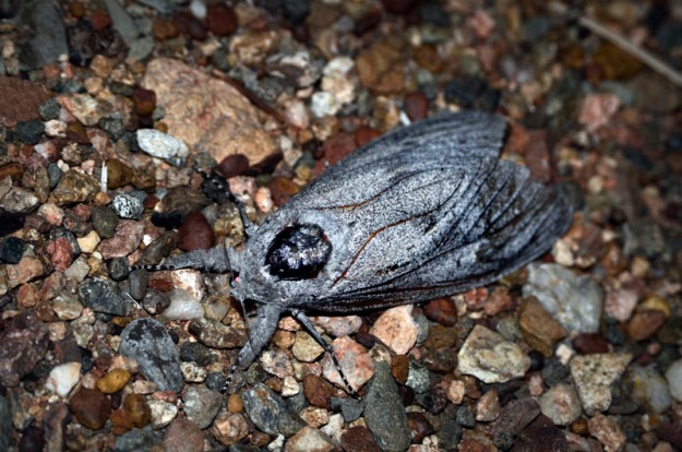
Big-arse Moth II, Caroline Pool, Halls Creek

Big-arse Moth II, Caroline Pool, Halls Creek

…about 6 cm long…

Big-arse Moth I, Caroline Pool, Halls Creek

Big-arse Moth I, Caroline Pool, Halls Creek

Caroline Pool, Halls Creek

Caroline Pool, Halls Creek

Met a mob here at Caroline Pool. They were here from Halls Creek, Fitzroy Crossing and Balgo for some Sorry Business – a young fella had died). But they were in good spirits evening and invited me to join them. They had killed a ‘cleanskin’ (an unbranded cow) and were now in the process of a big cook-up in a fire on the beach.

Burnt Rocks, China Wall, Halls Creek

Burnt Rocks, China Wall, Halls Creek

Rocks, Gums and Storm Clouds I, Halls Creek

Rocks, Gums and Storm Clouds I, Halls Creek

I.Kid.You.Not. – this is how it looked. One incredible combo of sunset, rocks, eucalypts and storm.

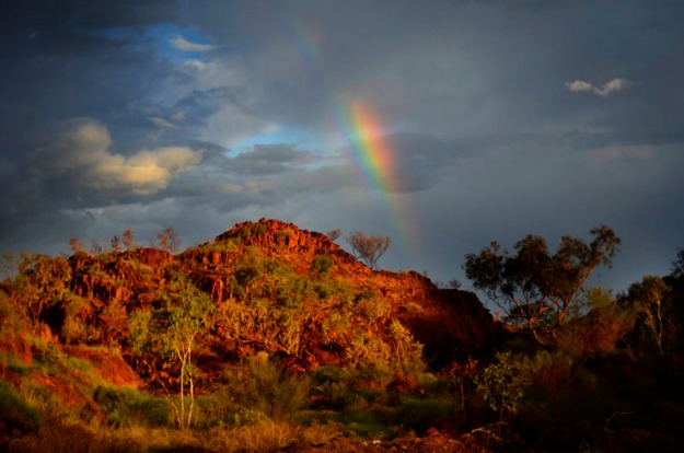
Rocks, Gums and Rainbow, Halls Creek

Rocks, Gums and Rainbow, Halls Creek

Rocks, Gums and Storm Clouds II, Halls Creek

Rocks, Gums and Storm Clouds II, Halls Creek

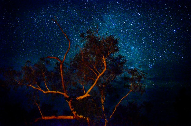
After dining with the mob at one of their houses, I returned to Caroline Pool to shoot the stars and eucalyptus by firelight, and this is what I got…

Gum Tree and Stars by Firelight, Caroline Pool, Halls Creek

Gum Tree and Stars by Firelight, Caroline Pool, Halls Creek

Above, 30 seconds. Below, 65 minutes.

Gum Tree and Star Trails by Firelight, Caroline Pool, Halls Creek

Gum Tree and Star Trails by Firelight, Caroline Pool, Halls Creek

Or, we could, (all together now, I think you’ve picked up on the pattern)……..CHOOSE TO HAVE MORE OF THIS INSTEAD…

Roadtrain I

Roadtrain I – washing the windscreen

The perfect combo: a roadtrain full of tyres for Humungous Mining Trucks.

And they’re great with kids too. Real friendly-like…

Children and Roadtrains II

Children and Roadtrains II

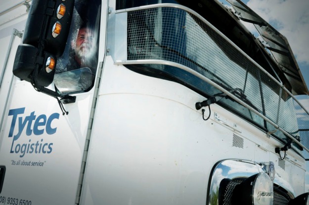
But in defence of the driver, Aaron, he was a damn good bloke, seriously, and generously agreed to let me jump in the  Kenworth Big-Rig to take a ride down the road and outa town (I walked back – he couldn’t even be bothered to chuck a U-ey and drop me back where I demanded!)

No, seriously again (I know, it’s hard for me), he was a lovely guy and damn I would love to drive one of those once in my life (the slippery slope – soon I’ll be like Colin the Croc with his building blocks).

Aaron and The Big Rig

Aaron and The Big Rig

Aaron, Ready to Roll

Aaron, Ready to Roll

In the Cab, checking for traffic (not telling me off)

In the Cab, checking for traffic (not telling me off)

Ok, that’s all folks. Thanks for staying with me. And don’t forget … SAVE THE KIMBERLEY…

…and those links one more time:

Minister Burke Petition re S18

Wilderness Society’s Kimberley Link – background info and simple ideas on how to help

The Goolarabooloo People, Paddy Roe Story and Lurujarri Trail

bye for now,

Hunter G

Images and Text Copyright Hunter G, 2013 (except the funky ‘Big Fridge’ one by Coinneach Shanks and ‘Caged Colin’, below) and available for sale (FREE for not-for-profit activities – so spread the word widely – just include a link to this blog). All profits from sales will be re-invested in Save The Kimberley activities.

Caged Colin

Caged Colin (Photo credit: DavidDMuir)

Big Fat Red Rock – Obligatory Post

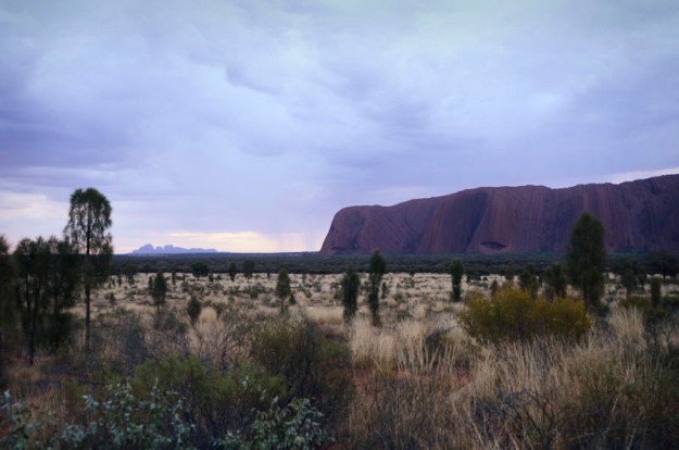
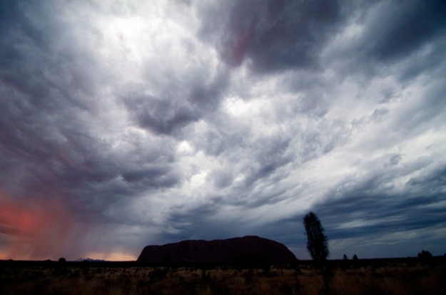
Approaching Sunset. Uluru and Kata Tjuta. A purplish tinge covers much of the land. Save The Kimberley

Approaching Sunset. Uluru and Kata Tjuta. A purplish tinge covers much of the land. Save The Kimberley

Sunset. Uluru and Kata Tjuta. Save The Kimberley

Sunset. Uluru and Kata Tjuta. Save The Kimberley

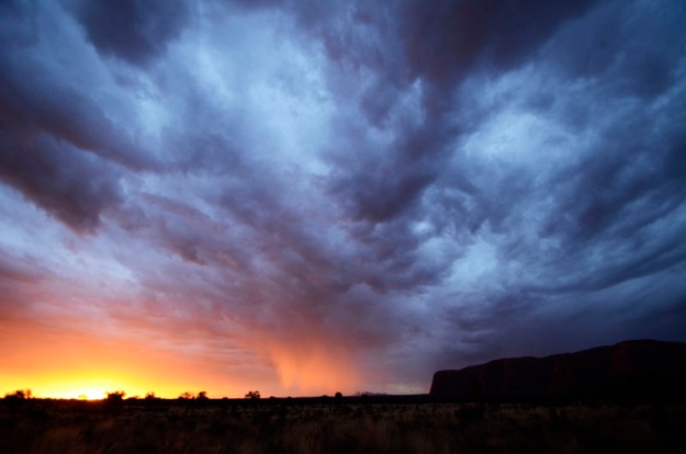
Sunset and Rainstorm. Uluru and Kata Tjuta. Save The Kimberley

Sunset and Rainstorm. Uluru and Kata Tjuta. Save The Kimberley

Dusk. Uluru and Kata Tjuta. Save The Kimberley

Dusk. Uluru and Kata Tjuta. Save The Kimberley

Uluru really does rock. Check it out before you’re dead.

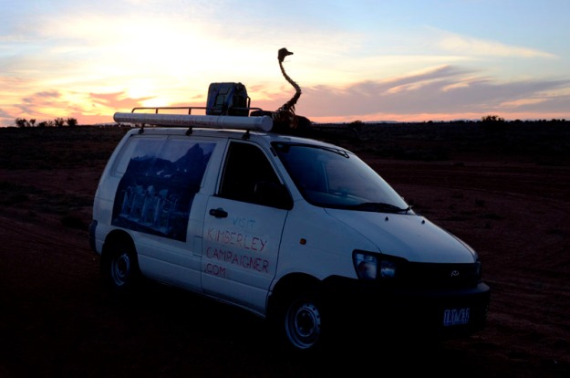
Claude the Damn Van in the Red Centre. Save The Kimberley.

Claude the Damn Van in the Red Centre. Save The Kimberley.

Claude and I are headin’ off today towards Alice Springs and beyond. See you soon. Bye for now,

Hunter G

Images and Text Copyright Hunter G, 2012 and available for sale (FREE for not-for-profit activities – so spread the word widely – just include a link to this blog). All profits from sales will be re-invested in Save The Kimberley activities.

SAVE THE KIMBERLEY. Visit Kimberley Campaigner.

Naming Rights: And the Winner Is ……….

Naming Rights: And the Winner Is……….Claude the Damn Van suggested by the lovely and mischievous Kat Hunter (no relation). Claude the Damn Van has accepted that his Christening name is a tongue-in-cheek show of love and affection.

He has been traveling bravely across the lands and, apart from a couple of blown fuses and an old-age fuel filter, is as healthy as when he began despite dodging suicidal wildlife,

Stare-Out Comp with Stubborn Roo.

Stare-Out Comp with Stubborn Roo.

…suffering flying stones while having circle-work done around him by post Calder Park Thunderdome enthusiasts

No Animals

No Animals

…suffocating in Oodnadatta Track dust, nearly getting bogged in the red soils around Uluru, being parked for the night in all sorts of locations,

Atop an Underground House at Sunrise in Coober Pedy

Atop an Underground House at Sunrise in Coober Pedy

…having to carry a tight-arse split-personality German… and an emu carcass (my fault).

Emu  Parade

Emu Parade

Thanks for helping Save The Kimberley, Claude. We love you.

Claude TDV Checkin' Out The Ochre Pit

Claude TDV Checkin’ Out The Ochre Pit

What Happens to Weaker Vehicles:

Victim_1

Victim_1

Victim_2

Victim_2

Victim_3

Victim_3

Victim_4

Victim_4

Victim_5

Victim_5

Victim_6

Victim_6

Victim_7

Victim_7

Claude The Courageous

Claude The Courageous

Visit Kimberley Campaigner for background info and simple ideas on how you can help.

Bye for now,

Hunter G

p.s. you can send your love to Claude TDV here anytime. 🙂

Images and Text Copyright Hunter G, 2013 and available for sale (FREE for not-for-profit activities – so spread the word widely – just include a link to this blog). All profits from sales will be re-invested in Save The Kimberley activities.

Every Time I Enter the River

Every Time I Enter The River

Every Time I Enter The River

Every time I enter the river I find myself facing Death – two cucifixes nailed to a River Redgum on the opposite bank.

The gum is the tallest of all its compatriots along the bank for several hundred metres in either direction. It leans slightly forward and upstream, as if bowing to the oncoming murky brown waters in thanks. A twisted matting of roots slides quietly down the bank, slightly downstream of the main trunk, seeking and softly sipping those waters which have just previously been greeted by the giant gum’s leaning body.

About two metres up the broad trunk there is a distinct line where the river has previously reached in healthier times. Below this line the trunk is a dusty grey and appears compressed, squeezed to its inner core. In the centre of this section, staring out across the river, is a hand-painted cross – originally a brilliant white but now a dirty, weathered, forgotten white. It has been painted directly onto the bark and is perhaps 50cm tall.

Above the watermark line the trunk is fuller and a broader range of earthy hues is restored – from the heavier dark brown-black of the larger pieces of bark (which tend to hang slightly loose but disappear altogether the higher up the tree one climbs), through the mid grey-brown hues and on up to the platinum greys and silvery whites, the newest layer of life’s protective and sustaining skin.

Again in the central area, but slightly larger than the one beneath, another white cross hangs silently. This one is white wood, a whiter, fresher, newer white, and is nailed to the trunk. It is, perhaps, marking a more recent claim.

Mostly unnoticed, except from certain angles and at certain times of day, are two small reflectors. Yesterday, while floating downstream, a silvery glint, glass-like, caught my eye, drawing my attention to the haunting presence of the crucifixes for the first time; a signal to approaching life to pause for a moment in remembrance and in thanks (for that unknown victim, for family and friends, and for life.

Meanwhile, the dispersing and evaporating white jet-streams of two long-passed planes intersected high in the sky, forming another cross to mark the place where hundreds may have ended their journeys had timing been different.

And later, at sunset, another glint catches my eye as I sit on the opposite bank watching the river flow. This time a bright orange, the sun itself, reflects off a second reflector, marking a farewell, the passing of another day, a life, and a journey completed.

As I set out to photograph this scene I discover another element – even less discernable than the reflectors. I only notice it, disbelievingly, through the 400 mm lens and review it over and over again to make certain my thoughts. I am still not certain (maybe it is a trompe l’oeil created eerily by  the tree’s bark and texture). But it seems there is a particularly haunting skull with deep black eye sockets and a mouth seemingly devouring the top of the crucifix. I see myself and all of us suddenly magnified and brought to life.

…………………..

A story from a couple of weeks ago on The Murray River @ Grace’s Bend.

Images and Text Copyright Hunter G, 2012 and available for sale (FREE for not-for-profit activities – so spread the word widely – just include a link to this blog). All profits from sales will be re-invested in Save The Kimberley activities.

Patriotic, Idiotic, Serious and Sublime

Hi folks, Hope you enjoy some of these highlights from the past few days. Click on a photo and scroll through the gallery. Any questions/comments, please fire away.

Bye for now,

Hunter G

ps Coober Pedy is a seriously weird, beautiful and frightening place. I’d forgotten how much I love it. It was apparently a pivotal location in Wim Wender’s film, ‘Until the End of the World‘ (It looks like Purnululu (Bungle Bungle) also features) …

There is also an interesting critique of the film here.

Images and Text Copyright Hunter G, 2012 and available for sale (FREE for not-for-profit activities – so spread the word widely – just include a link to this blog). All profits from sales will be re-invested in Save The Kimberley activities.

Silver City Highway – Part 2

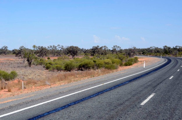
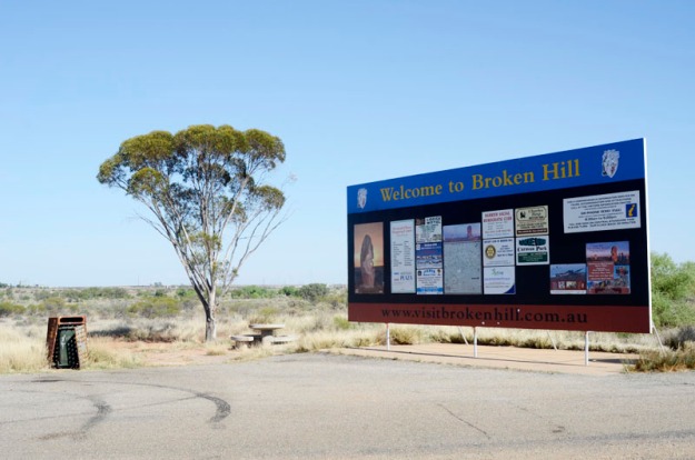
A few pics to fill in the space that lies between Mildura and Broken Hill

Approaching The Silver City Highway

Weed Spraying

Who’d o’ thought, way out here in the middle o’ nowhere? He stopped, asked me what I was doing. I said, shooting’ road kill. He didn’t flinch – I like the unquestioning, non-judgemental acceptance.

 We stood under the blazing sun chatting for half an hour: me getting some outback driving tips from him; and he telling me stories of bush politics, the need for weed spraying/roadside grading to keep the wildlife away from the road edges where any occasional rain runs off and collects, tempting the animals to tempt fate for a lovely fresh feed. $800 a kilo for the chemical spray, 3 kilos worth, lasts for about 9 months; and telling me how one of Australia’s most financially successful photographers, Ken Duncan, stayed on his farm a couple of decades ago to create a photo-essay. He was always with camera and up pre-dawn every day to catch the sunrise.

Roo

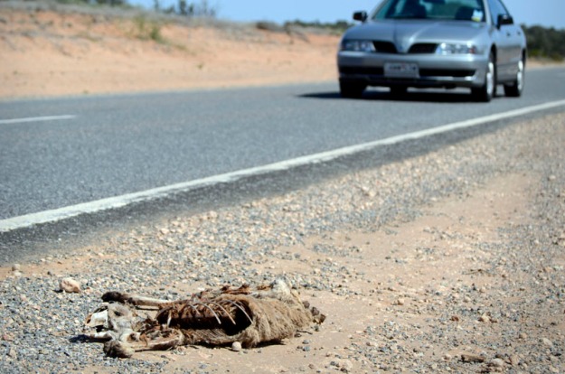
…but despite the weed spraying, it doesn’t always go to plan. In fact there was enough road kill out here to sink the proverbial ship.

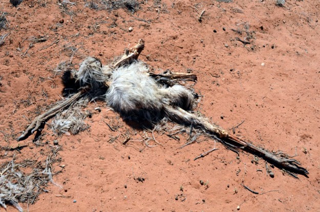
Emu

…an extraordinarily beautiful and moving sight. What a striking resting pose.

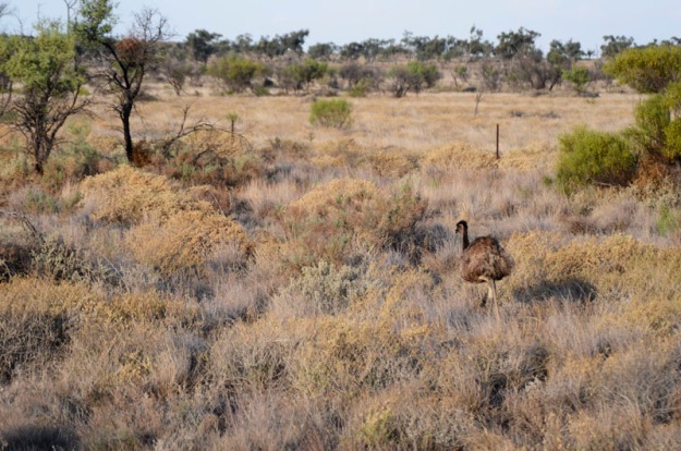
Emu

…and here’s a beautiful live one to help balance the emu ledger and keep you squeamish folk on board 🙂

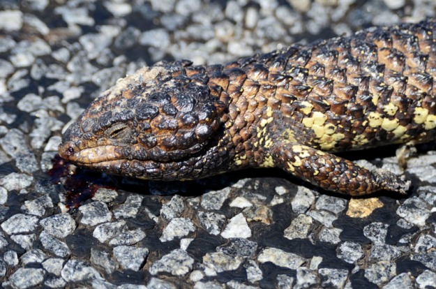
Emu

…but not so lucky this poor beautiful lizard. Is it a blue tongue? He looked fine from a cpl of metres away, and I almost expected him to lazily move on when I approached.

Lizard

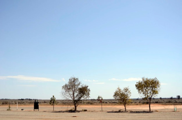
Rest area, complete with Christmas tinsel…but virtually no shade…

Christmas Rest Area

…and then more of this…

Roo

…but then this oasis nearly smack-bang between Mildura and Broken Hill. Lake Politah, a natural lake, a drinking hole for many forms of fauna – unfortunately including beautiful but feral goats.

Lake Politah

The goats and other fauna make it v difficult to re-establish the woodlands of Black Box Gum and native Cypress Pine that used to surround these parts until, YOU GUESSED IT, whitefellas cut nearly all of ’em down for various reasons. The pine is v slow growing and therefore a v hard wood, resistant to termites, so was a favoured building material. And I think it was the Black Box that was used to power the steam trains.

Despite the signs informing us folk of their fragility, even at the rest area, limbs had clearly been snapped off the pines. Probably for a campfire. Baggghhhh!

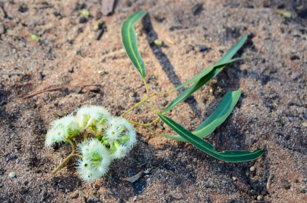
Flowering Gum. Yummmm! Lovely delicate fragrance…

Flowering Gum

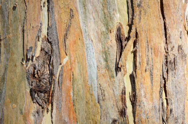
Eucalyptus Bark Patterns

And more bark patterns, in the form of ‘Tree Graffiti‘ – always a fairly common sight in remote parts but have any of you, like me, noticed a growing trend in this form of graffiti in Melbourne? I have, but mostly tagging as opposed to legible names.

Nice to see that legendary American photographer, Edward Weston, made a trip here to the middle of nowhere and left his mark…and only last year. Amazing! 🙂

What Bird is That? Anyone? Anyone?

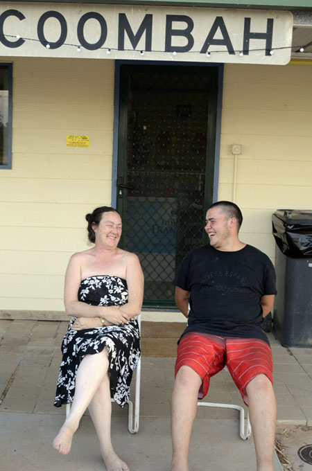
And just a little further up the road I rolled into the only ‘town’ to speak of b’w Mildura and BH.

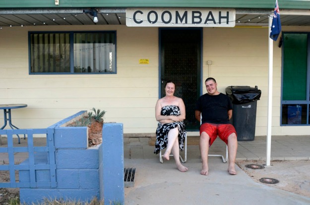
Coombah Roadhouse

Actually, there’s no town at all to speak of. Just ‘June’s Place’, where you can get petrol, make a phone call at the Telstra phone-box (!), use the dunny (but ONLY if ya buy something), order from the ‘a la carte’ menu (‘mm, not totally sure that even I’d risk that, in fact I didn’t – I politely changed my original order to “nothing…I’m not actually feeling that hungry” (hygiene seemed to be slightly, just slightly, lacking).

Sorry, No Petrol

But, if you’re really lucky, you might get to chat to June, herself….

June & Son

I got the distinct feelin’ that ya don’t mess with June. It’s ‘June’s Place‘ after all.

June & Son

Heaps of these bearded fellas and sheilas about…

Feral Goats

It was a fiercely hot day and even the bitumen couldn’t hold it together…

Heat Exhaustion

Melting: Bitumen & Me

The melting bitumen and me. My boots began sticking to the road with each step! Felt like Coyote about to get caught in a creative Roadrunner trap.

On The Road

And then it began – the nightly piritechnico spectaculo! Incredible silent scenes…

Sunset

Sunset Swirls

Storm

Moonrise & Lightning

And then night-proper descended…

Stare-Out Competition.

It’s difficult to drive, photograph and avoid fauna all at the same time! Stubborn Roo! Stubborn Hunter! We eventually came to a compromise and both have stories to tell our mates as a result.

Eventually I rolled into the ‘Welcome to Broken Hill’ roadside pullover where I decided to spend the night, just under that tree over there, past the burn-out skid-marks and burned out rubbish bin enclosure. And just next to the delightfully stark concrete table with its reassuring message…

Welcome to Broken Hill

Welcome to Broken Hill

‘Mm. Welcome to Broken Hill!

But I did wake to this. Not bad for ZERO dollars a night.

Room with a View

Images and text Copyright Hunter G, 2012 and available for sale.