Tag Archives: Shell

Some Things I Saw – Part 3

And so we hit the road again, this time for the final leg to the West Coast and only 50 km south of the seriously threatened Walmadan (James Price Point), traditional country of the Goolarabooloo Jabbirr Jabbir peoples and the warrior, Walmadany, who once lived there.

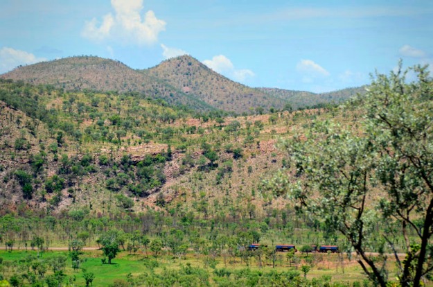
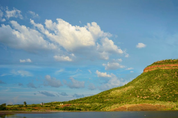
Halls Creek (the beautiful, intriguing and tasty innards) to Broome (pearling mecca and home of The Pigram Brothers).

Great song which refers to Walmadan…

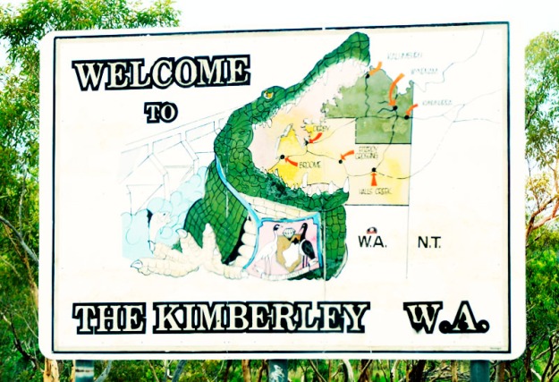
The Kimberley

The Kimberley

Once again before we depart, a warning as per previous Some Things I Saw posts – more pics below of beautiful, but deceased, animals.

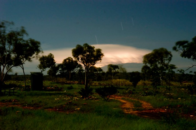
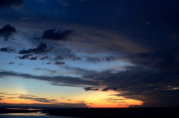
Afternoon Storm and Sunrays I, Near Halls Creek

Afternoon Storm and Sunrays I, Near Halls Creek

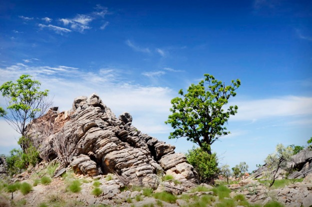
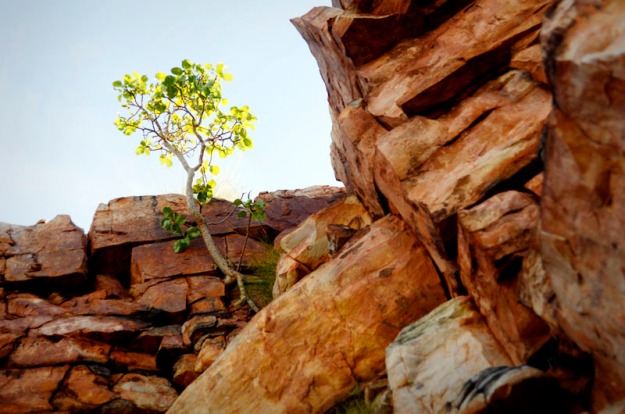
Rocky Outcrop, near Halls Creek

Rocky Outcrop, near Halls Creek

Afternoon Storm and Sunrays II, Near Halls Creek

Afternoon Storm and Sunrays II, Near Halls Creek

White Man's Trash

White Man’s Trash

Who is Hunter G II

Who is Hunter G?

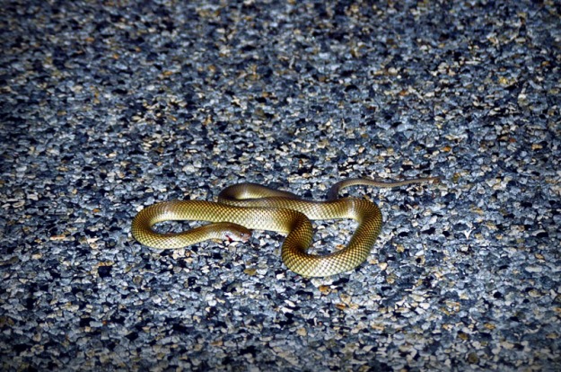
Road Victim, Injured Snake

Rather Annoyed Snake

The rather annoyed snake, above, had just been hit by a car and was bleeding from the side of its head. Helped it off the road with my tripod. And do ya think it was grateful? Not so much as a ‘thank you’. Just rearing and hissing. So I reversed over it before continuing on. Not.

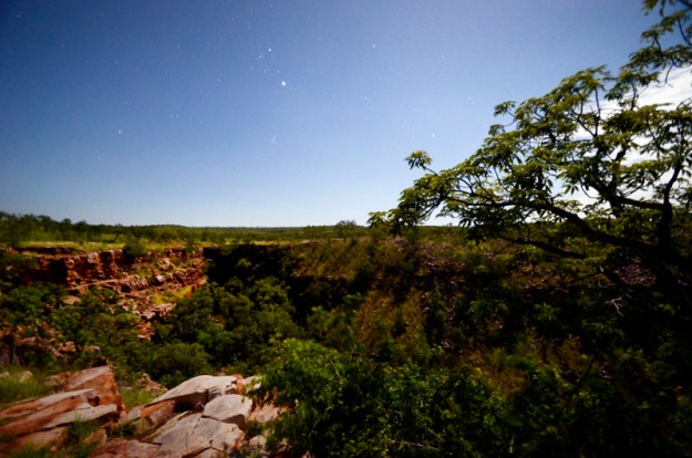
Dawn, Rest Area near Halls Creek

Dawn, Rest Area at Numpan Hills

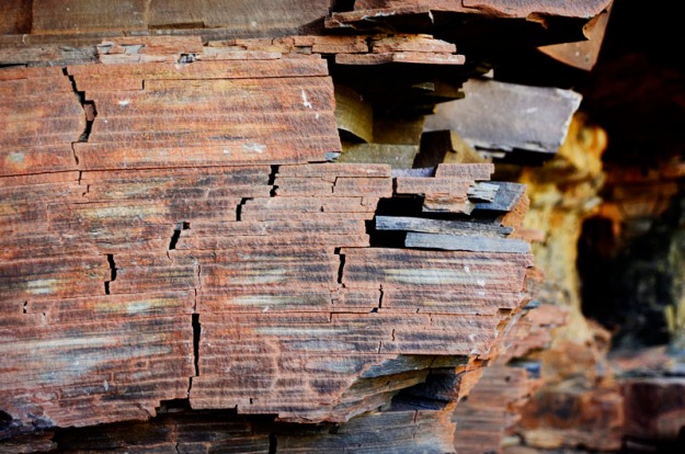
Numpan Hills I, near Halls Creek

Numpan Hills I, near Halls Creek

Beautiful colours and forms.

Numpan Hills II, near Halls Creek

Numpan Hills II, near Halls Creek

Numpan Hills III, near Halls Creek

Numpan Hills III, near Halls Creek

Numpan Hills IV, near Halls Creek

Numpan Hills IV, near Halls Creek

And here’s WA Premier, Colin Barnett, below, beer-bellied but hard at work plugging himself as usual and thinking dirty thoughts – “what’s in dem hills below? Will they make me immortal if I dig’emupandsell’em?”
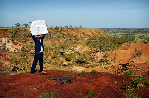
Colin Hard at It - Numpan Hills, near Halls Creek

Colin Promoting his Personal Philosophy – ‘1 + 1 = Whatever The Hell I Want’. Numpan Hills, near Halls Creek

Road Kill Scar

Road Kill – scar of burned out car

Numpan Hills, near Halls Creek

Numpan Hills, near Halls Creek

Above, reminds me a little of Monument Valley, Utah, USA. Let the drooling begin, a la Homer Simpson. ‘Mmmmmmmmmmmmmmmmmmmmm…

Things that make Homer go ‘Mmmmmmmmm…

Below, Limestone country to the left, Sandstone country to the right.

Limestone & Sandstone, Numpan Hills

Limestone & Sandstone, Numpan Hills

Swimming, Fitzroy River, Fitzroy Crossing

Swimming, Fitzroy River, Fitzroy Crossing

Fitzroy River Patterns, Fitzroy Crossing

Fitzroy River Patterns a la Michael Leunig, Fitzroy Crossing

For some reason the above image reminds me of Michael Leunig cartoons….

Michael Leunig - Inner Duck

Michael Leunig – Inner Duck

And if you want a greater insight into the working’s of this great cartoonist, artist, philosopher’s mind, here’s an interview with Leunig by Margaret Throsby from ABC Classic FM (takes a while to load).

Kids Swimming, Fitzroy River, Fitzroy Crossing

Kids Swimming, Fitzroy River, Fitzroy Crossing

Raptor at Dusk, Fitzroy River, Fitzroy Crossing

Raptor at Dusk, Fitzroy River, Fitzroy Crossing

Net Fishing, Fitzroy River, Fitzroy Crossing

Net Fishing, Fitzroy River, Fitzroy Crossing

Geike Gorge National Park I, Fitzroy River, Fitzroy Crossing

Geike Gorge National Park I, Fitzroy River, Fitzroy Crossing

‘Mm, I think these are both weeds, above and below (Passion weed?). But beautiful nonetheless….and much safer than an invasion of Barnettus Colinus.

Geike Gorge National Park II, Fitzroy River, Fitzroy Crossing

Barnettus Colinus, below…

Barnetus Colinus - Invasive Species

Barnetus Colinus – Invasive Species

Don’t say I didn’t shoot a croc – you can see the snout, below, breaking the waterline just inside the tip of my high quality, giant red Croc. So there!

Achtung! Crocodile! Geike Gorge National Park IV, Fitzroy River, Fitzroy Crossing

Achtung! Crocodile! Geike Gorge National Park IV, Fitzroy River, Fitzroy Crossing

Geike Gorge National Park V, Fitzroy Crossing

Geike Gorge National Park V, Fitzroy Crossing

Damn fine wet season grass, above. And striking rocks, below.

Geike Gorge National Park VI, Fitzroy Crossing

Geike Gorge National Park VI, Fitzroy Crossing

Geike Gorge National Park VII, Fitzroy Crossing

Geike Gorge National Park VII, Fitzroy Crossing

Below – Damn it, just after I said to myself,  “Hunter, you said you’d be sensible on this road trip and focus on the main ‘Save The Kimberley’ objective. Stop following this dodgy road or you’ll end up bogged. Turn around.” So I did. And got bogged in the process!

Step One, below – dig a bit and throw some wood around…

Bogged I - Fitzroy Crossing

Bogged I – Fitzroy Crossing

Step Two, get in driver’s seat and drive…backwards probably best.

Bogged III - The Road Ahead, Fitzroy Crossing

Bogged II – The Road Ahead, Fitzroy Crossing

Step Three, below – fail! Show concern, then start again.

Bogged II - Fitzroy Crossing

Who is Hunter G? Bogged III – Fitzroy Crossing

Below – Starting again, this time with the assistance of the City of Melbourne.

Bogged IV - Authorised Vehicles Excepted, Fitzroy Crossing

Bogged IV – Authorised Vehicles Excepted, Fitzroy Crossing

But Failed Again!

Step Four – Give Up! Call RACV via RACWA, over to RACV back to RACWA back to RACV, over to Towie… wait for ages…but make the most of the Total Care you paid for…and get them to tow you all of 3 metres at a cost (to them) of about $180. Yep. Worth every penny despite the dent to my manliness. To mitigate my manly losses just keep in mind that I’m a newby in the tropics, it was about 40 degrees celcius, 70% humidity and I gave it a red hot go for a couple of hours.

Exhausted and filthy as a result of the misadventure, I decided to stay in official accommodation for the first time on the trip thus far and get myself cleaned up. I chose to stay at the top o’ the line, Tarunda Caravan Park where I met the supportive couple, below, at the shower block.

Lizard & Cicada

Lizard & Cicada

Infinitely better hangin’ out with them than the other close-encounter I had – a man in his fifty’s who hung outside his caravan IN HIS Y-FRONTS while listening to Neil Diamond‘s ‘Cracklin’ Rosie‘ for an extended period.

Cracklin Rosie…

In my humble opinion, y-fronts should be banned. However, if due to some vagary of personality you would in fact like to see more, I suggest you visit here for a general Y-front overview. Or here, here..and here for the good, the bad and the downright weird (respectively? I’m not saying. So be prepared!)

And here are two more of our favourites in their finest…

Homer, Tribal Man & Donut

Homer, Tribal Man & Donut

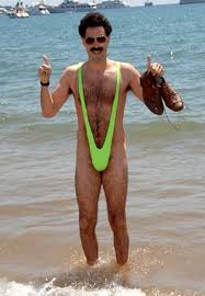
Borat in his Finest

Borat in his Finest

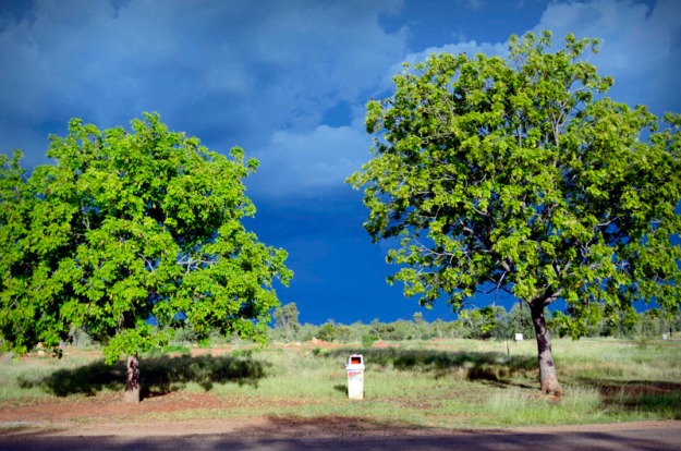
Rubbish Bin & Approaching Storm

Rubbish Bin & Approaching Storm

I love that bin. Yeah, that one, above.

Ahhhh, let the off-highway adventure begin. On the Leopold Road, heading towards Tunnel Creek and Windjana Gorge where the Aboriginal warrior, Jandamarra hid out during his brave attempts to repel the whitefella settlers.

Oscar Range, Leopold Road

Oscar Range, Leopold Road

Quarry, Leopold Road

Quarry, Leopold Road

So, there we were, Claude and I, driving along Leopold Road in the middle of beautiful wild nowhere when we rounded a bend and copped this obscenity (below) in the face. Suddenly, out of the remote blue, a billboard promoting Wesley fucking College private school from Melbourne. Only a private school sense of entitlement would result in this sort of advertising in the wilderness. Nowhere else did I see anything remotely like it. The only other signs around in this sort of terrain were humble signs noting one’s passing of such-and-such cattle station.

Sense of Entitlement - Wesley College Private School, Leopold Road

Sense of Entitlement – Wesley College Private School, Leopold Road

Abandoned Combi - Leopold Road

Abandoned Combi, with Nazi Swastika – Leopold Road

And then, drum roll, Claude’s and my first real test….

Approaching Bog - Leopold Road

Approaching Bog – Leopold Road

And then, Claude’s and my first MAJOR fail…

Bogged I - Leopold Road

Bogged I – Leopold Road

Damn it, I was so close. I’d tested the solidity of the ridges, picked the most suitable ones…and then simply misaligned the bloody wheels and slipped off the edge. Bugger! Bogged!…

Bogged II - Leopold Road

Bogged II – Leopold Road

… for TWENTY-SEVEN long, isolated yet mostly enjoyable hours!

Step One – I tried the obvious, below. A bit of the old rock wedging under and around.

Bogged III - LH Rear - Leopold Road

Bogged III – LH Rear – Leopold Road

Bogged IV - RH Rear - Leopold Road

Bogged IV – RH Rear – Leopold Road

Step Two – jump in the driver’s seat, look happy (too happy perhaps) and try to convince yourself and the Gods that all is OK! And drive!

Who is Hunter G? Bogged VI - Leopold Road

Who is Hunter G? Bogged VI – Leopold Road

But fail. All was not OK. And, once again, it was about 40 degrees celcius.

Step Three – Begin again. In an attempt to reverse the near-25-degree tilt that Claude ended up on when we first got bogged I whacked the jack under the back LEFT wheel and jacked away, expecting weight to be shifted to the RHS. But what’d we end up with? This…

Bogged VI - RH Rear - Leopold Road

Bogged VI – RH Rear – Leopold Road

Yep, the left wheel went nowhere but the right one headed further skyward, instead of earthward as I had predicted. Weird and uncanny. But more likely that the high school physics recollections that I employed were way off track.

Step Four – But at least it meant I could jam a shiteload more rocks under the rear RHS wheel which had previously been spinning like a top. But unfortunately I didn’t notice the small sharp edge on one of dem rocks that resulted in part of the tyre being shredded when I next tried to drive away.

And so, NEXT IDEA…

Step Five – Tried again to level Claude, this time by jacking the front LH wheel up while digging a dirty big hole for Front RHS Wheel. Yay! This worked – eventually the jacking and digging led to a collapse and levelling.

Bogged VII - RH Front - Leopold Road

Bogged VII – RH Front – Leopold Road

I then left the jack in place with the intention of eventually driving straight off the top of it. Unorthodox? Perhaps. But before that could happen I decided it’d be necessary to go the whole hog’ and re-sculpt the road ahead, cutting away high bits to fill in the lower boggy bits.

Bogged VIII - LH Front - Leopold Road

Bogged VIII – LH Front – Leopold Road

Obviously at this point (god knows when exactly) I grew tired of documenting things for you folks so this is where the visual journey ends. I was prepared for up to about a five day wait while slowly working on various de-bogging options. And if five days did roll around and I was still bogged, the vague plan was to carry as much water as possible and walk back out to the highway, a distance of about 50 km, over two nights, knowing that there were at least a couple of creek crossings along the way.

At some point, one day turned into another – ah, yes, that occurred before the leveling because I remember trying to sleep in Claude on a 25 degree angle and continually rolling into the lower wall, readjusting…and then rolling again into the lower wall, and so on and so on. The following day, during my heat-o’ the day nap’ when I’d downed tools to stop from dying of heat exhaustion, I had a vision….

…not of the holy Brahmin bull below (fine specimen though he is), but of two humans approaching slowly. In my dazed state, they may have been Adam and Eve (but then, who would’ve I been?).

Adam and Eve - Victor Brauner, 1923

Adam and Eve – Victor Brauner, 1923

In fact they were Mike and Trudy, heading out on a hot date to Tunnel Creek. But instead of romance they found themselves wondering whether they had just found a dead man lying in the back of his Toyota TOWN Ace (‘mmm, perhaps Claude’s ‘make and model’ should’ve alerted me to the dangers of 4wd’ing in a bloody TOWN Ace!!!). Anyway, Mike and Trudy thought I was dead. But in the third minute I awoke, dazed and, yes, you guessed it, confused…at least for 60 seconds or so as I rolled over, looked up at the vision, clumsily extracted myself from Claude’s innards and groggily walked towards them. After the surrealist vision wore off I realised I was in good hands. Not God’s hands. Good hands. Real live hands. My time was up.

Brahmin Bull, Leopold Road

Brahmin Bull, Leopold Road

And to cut an already long story a little short, they towed me out and I returned whence I came, successfully rejecting the inner voice telling me to venture on.

I returned to Fitzroy Crossing, but not as far as Tarunda Caravan Park and the man in his Y-fronts. Oh no, not that far back, that was for sure. I had already suffered enough. Never get out of the caravan. Whatever you do, never get out of the caravan…in your fucking Y-fronts, no matter who the hell you think you are or what funky Neil Diamond track you might be listening to. Just don’t do it!

A tenuous link. Because I can…

“Never get out of the Boat”

And continuing in the vaguely related gruesome vein of Apocalypse Now, I offer thee…

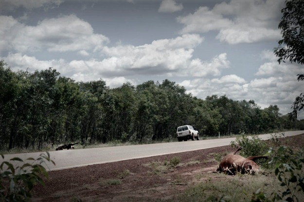
A white landcruiser, A cow and A bull. Switch off now if you are sensitive to death.

The landcruiser had managed to take out two large beasts, leaving everyone in very bad shape: two dead beasts, a written off car and an unknown final outcome for passengers, although hair caught in the cracks of head-butted, crazy-paved windscreen didn’t imply a fun experience.

Road Kill, Bull

Road Kill, Bull

Road Kill, Cow

Road Kill, Cow

Road Kill Trio

Road Kill Trio

Another darkly beautiful scene – Phantom of the Operatic Outback…

Road Kill, Cow III

Road Kill, Cow III

Road Kill, Cow II

Road Kill, Cow II

Road Kill, Cow I

Road Kill, Cow I

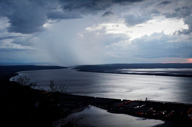
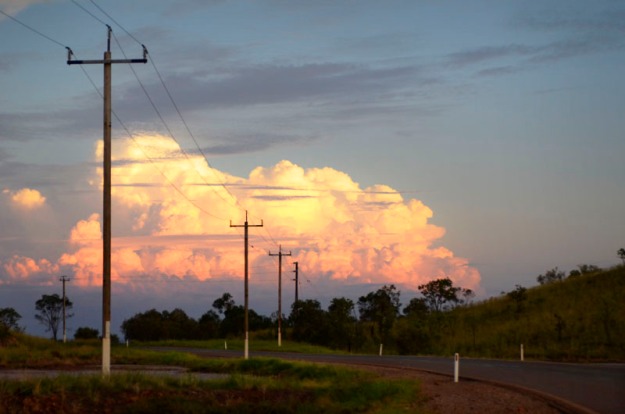
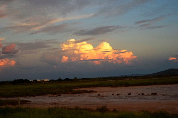
But things always lighten up again at some stage, even though a storm always lurks in the distance…

Cumulus Nimbus II, Fitzroy Crossing

Cumulus Nimbus II, Fitzroy Crossing

Cumulus Nimbus I, Fitzroy Crossing

Cumulus Nimbus I, Fitzroy Crossing

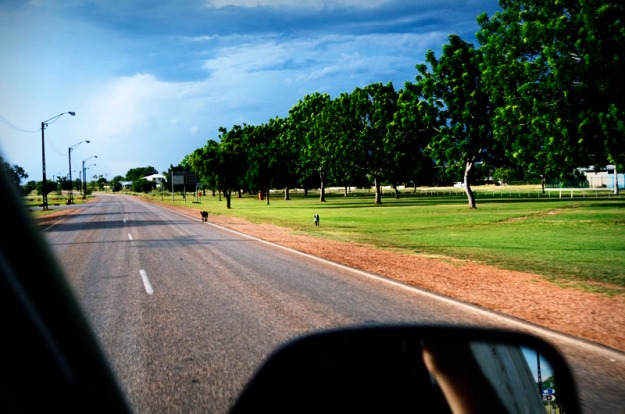
And so I returned once again to Fitzroy Crossing……and a welcoming party of two daredevil dogs that made every car, truck and even road-train run the gauntlet.

Dog Rage I, Fitzroy Crossing

Dog Rage I, Fitzroy Crossing

Dog Rage II, Fitzroy Crossing

Dog Rage II, Fitzroy Crossing

Dog Rage III, Fitzroy Crossing

Dog Rage III, Fitzroy Crossing

After a quick refuel Claude and I left town again that evening, bound for Derby, about 250 kms NE of Broome. I was finally getting close. Close to the west coast.

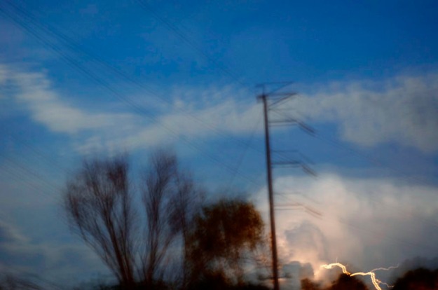
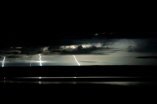
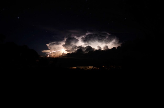
Soon after leaving Fitzroy Crossing, we were presented with an inspiring electrical storm in the distance ahead. Here are some abstract sort-of-shit-sort-of-interesting-thru-the-windscreen-while-driving shots of the action. Sort of depends on who’s viewing and/or what substances have been imbibed/injected. Over to you…

Storm over Highway III

Storm over Highway III

Storm over Highway II

Storm over Highway II

Storm over Highway IV

Storm over Highway IV

Storm over Highway I

Storm over Highway I

Storm over Highway V

Storm over Highway V

A painfully beautiful aside…

'Lightning Flower' - Image from ArmageddonOnline

‘Lightning Flower’ – Image from Armageddon Online

Above, the resulting scarring from a lightning strike.

Claude and I arrived in Derby ’round midnight, and chose the wetlands on the edge of town as our home for the next few nights.

Termite Mound and Boab

Termite Mound and Boab

Bee with Pollen, Derby Wetlands

Bee with Pollen, Derby Wetlands

Derby Wetlands II

Derby Wetlands II

Malformed Flying Formation

Malformed Flying Formation

Derby Wetlands I

Derby Wetlands I

The Boab Prison Tree on the outskirts of town – a dark history for a beautiful tree estimated to be 1500 years old:

The Boab Prison Tree IV, Derby

The Boab Prison Tree IV, Derby

Before Derby was established in1883, Aboriginal people were kidnapped. The kidnappers, known as blackbirders, were settlers connected with the pearling industry. They wanted divers and workers for the boats. They rounded people up and put them in chains and held them at the Boab Prison Tree while they waited for a boat. Later prisoners were held here awaiting trial in Derby.

The Boab Prison Tree I, Derby

The Boab Prison Tree I, Derby

The Boab Prison Tree II, Derby

The Boab Prison Tree II, Derby – Graffiti

The Boab Prison Tree III, Derby

The Boab Prison Tree III, Derby

Back in town I came across this funky propeller-gum combo. The propeller, from the sunken cargo ship S.S. Colac, was installed in 1964 and has been gradually engulfed by this adventurous eucalyptus.

Human Nature III, Derby

Human Nature III, Derby

Human Nature II, Derby

Human Nature II, Derby

Human Nature I, Derby

Human Nature I, Derby

Petroleum, Eucalyptus & Boab

Petroleum, Eucalyptus & Boab

The last known substantial population of the endangered Freshwater Sawfish lives here in the Fitzroy River. Another reason why mining The Kimberley makes such amazing sense.

Freshwater Sawfish, Wyndham

Freshwater Sawfish, Wyndham

Car Tracks at Sunset, Wyndham

Car Tracks at Sunset, Derby

And then it was back on the road for the last leg: Derby – Broome.

Fitzroy River

Fitzroy River, further downstream from Fitzroy Crossing

White Man's Trash I

White Man’s Trash I

White Man's Trash II

White Man’s Trash II

Ski Lake

Ski Lake

Ski Lake Patterns II

Ski Lake Patterns II

White Man's Trash I

White Man’s Trash – bottle

Ski Lake Patterns I

Ski Lake Patterns I

Termite Field

Termite Field

Termite Mound

Termite Mound

And finally, after 8410 massive and mostly enjoyable kilometres, I rolled up to Minyirr (Gantheume Pt) at sunset. My coast to coast odyssey was over… but I still had 60-odd km to travel by road before I reached Walmadan, the sacred yet seriously threatened site where WA Premier, Colin Barnett, desperately hopes to build the world’s largest Liquefied Natural Gas processing plant.

If successful, the LNG gas plant will be the beginning of the end for the world-renowned Kimberley region, one of the last remaining wilderness regions of its type in the world. And one which is extremely rich in cultural history. It would be an incredible, irreversible tragedy to lose all of this. Yet despite cheaper and more environmentally/culturally appropriate alternatives (pre-existing infrastructure in The Pilbara would be $15 B cheaper OR using new foating LNG technology would be $9 B cheaper) Barnett is adamant that the plant must be built at Walmadan. The real reason for his obsessive and irrational determination is his extremely dangerous ego which hopes to see his name go down in history as having burst open and industrialised the entire Kimberley to greedily and short-sightedly gorge on its buried wealth. A sickening thought.

Lighthouse at Gantheume Point

Lighthouse at Gantheume Point

The pindan at Minyirr, below, was rich underfoot and in striking contrast to the cyan sea and faded yellow-orange sky.

Gantheume Point (Minyirr) IV, Broome

Gantheume Point (Minyirr) IV, Broome

Lurujarri Heritage Trail, Minyirr

Lurujarri Heritage Trail, Minyirr

The Lurujarri Heritage Trail, above, follows part of a sacred songline which runs along the Dampier Peninsula through the currently threatened site of Walmadan (James Price Point). The trail, beginning here and ending 82 kilometres north, was set up by Aboriginal Elder, Paddy Roe (recipient of an Order of Australia medal) in a generous and intelligent attempt to bring two very different cultures together in the interests of shared knowledge, greater understanding and furthering reconciliation. But this is  to be destroyed if Barnett’s vision for Walmadan succeeds. Walmadan, the trail and the songline (a continuous path which cannot exist in separate physical parts) will be destroyed – an horrific legacy of an egomaniac.

Gantheume Point (Minyirr) III, Broome

Gantheume Point (Minyirr) III, Broome

Gantheume Point (Minyirr) II, Broome

Gantheume Point (Minyirr) II, Broome. Cable Beach in the Distance.

Gantheume Point (Minyirr) I, Broome

Anvil, Gantheume Point (Minyirr) I, Broome

Do what you can. Thanks for listening and bye for now,

Hunter G

ps At this stage the best thing one can do to help would be to write to Federal Minister for the Environment, Tony Burke, who still has to give his approval for the project to go ahead. Visit the following links for letter writing tips and other ideas too.

pps. Interesting fact…Did you know that Hunter G just received a grant to help with production of his Save The Kimberley exhibition which will open in Melbourne in May (details to come)? He will be exhibiting with Kimberley painter, Tom Montgomery. Thanks to the Awesome Foundation for their grant.

Now for those links:

Broome Community’s ‘No Gas’ Website

Environs Kimberley

Wilderness Society’s Kimberley Link

Images and Text Copyright Hunter G, 2013 (except where noted) and available for sale (FREE for not-for-profit activities – just include a link to this blog). All profits from sales will be re-invested in Save The Kimberley activities.

West Side Story – Kimberley Under Threat.

The following is taken from my colleague’s article published in The Big Issue magazine (Edition #426). Read the unedited version below.

West Side Story

With a state election looming in Western Australia on 9 March, Charlie Sublet travels to an area of The Kimberley that is under threat from a proposed Liquefied Natural Gas processing plant.

 This article contains references to Indigenous Australians who have died.

It’s 6am and I’m sitting on the dunes overlooking the vast Indian Ocean as it continues its ceaseless roll to shore. Morrning Glory, a wild vine with medicinal properties winds across the earth. Jagged rocks, burning amber under the rising sun, litter the beach. Welcome to Walmadan, an ancient and special place lined up for imminent destruction.

The Cliffs at Walmadan (James Price Point)

The Cliffs at Walmadan (James Price Point)

Walmadan (aka James Price Point) is a sacred Aboriginal area on Australia’s north-west coast, 50km north of Broome. It makes up part of the vast and pristine Kimberley region, one of the world’s last great wilderness areas. Named after the warrior, Walmadany, who fiercely protected his people against invaders, Walmadan is home to the Goolarabooloo Jabirr Jabirr Aboriginal peoples, the area’s traditional custodians. It sits on a songline – a continuous source of spiritual, cultural and physical sustenance.

Sixty-three days living in a van and 8460 km via a rambling route from Melbourne leave me here in this critically endangered place. I came because I had to, struck by a profound realisation that left me sleepless for five nights. The realisation was more ‘felt’ than rational, what some aboriginal people refer to as ‘lian’ (gut feeling). And perhaps it also reflected their belief that one’s relationship to the earth is reciprocal.

There is, however, a proposal by WA Premier Colin Barnett to build Browse LNG, the world’s largest Liquefied Natural Gas (LNG) processing plant, which will destroy this songline and affect the entire Kimberley region. The plant (a joint venture involving, among others, Shell, BP and PetroChina) would cover approximately 25 square kilometres, require dredging of 34 million tonnes of seabed in a humpback whale calving area, involve 8000 workers and increase the state’s greenhouse gas emissions by 50%. It will tear apart the environmental, cultural, and social fabric of the region. Even so, Barnett has described the plant as simply “a giant refrigerator” (Q&A, ABC TV, 5 Nov 2012) and he has made his long-term intentions clear: the Kimberley will become the state’s mining hub for the next 50 years.

The Kimberley Metals Group Loading Yard at Wyndham. Inappropriately set in a sensitive mangrove and mudflat ecosystem.

The Kimberley Metals Group Loading Yard at Wyndham. Inappropriately set in a sensitive mangrove and mudflat ecosystem.

A recent New York Times article listed the Kimberley as one of the world’s top destinations, while also noting the grave threat from mining. If this proposal is passed, the resulting port will provide a massive incentive to mining corporations to enter the region. In the past decade there has already been a 500% increase in mining applications here.

This is a matter of international significance, like the ‘No Dams’ Franklin campaign of the 80’s which fortunately resulted in that hidden gem being saved and listed as a United Nations World Heritage Area.

The Kimberley is extremely rich in environmental and cultural elements, including geological wonders such as the Bungle Bungle, wild rivers, rainforests, pristine coastline, extensive rock art and incredible wildlife. In the northern Kimberley, unlike anywhere else in Australia, there are no recorded mammal extinctions, and new species of flora and fauna are continually being discovered.

The Kimberley’s beauty and significance go way beyond the visual and verbal. It is profound. It contains a space that enables one to fully relax and to experience a connection to something far, far greater than any of us. There exists a deep sense of belonging and calm in its wildness.

South Central Kimberley

South Central Kimberley

Twenty-five years ago, Aboriginal elder Paddy Roe created the 82 km Lurujarri Heritage Trail, which runs through Walmadan. It was Roe’s vision to share his culture and heritage with non-Aboriginals to foster understanding and reconciliation. Thousands of people have since walked this trail. Roe, now deceased, received an Order of Australia Medal, yet his legacy and many of his ancestors’ graves are at serious risk of being desecrated. Woodside were recently given approval to “excavate, destroy, damage, conceal or in any way alter” the area despite it being recognised under the Aboriginal Heritage Act. Imagine a similar activity at sacred graves of Anglo-Australians – war hero Weary Dunlop, perhaps, or sporting legend Don Bradman. It wouldn’t happen.

If the project goes ahead, the trail, Walmadan and the songline will be destroyed. A songline is a continuous living cycle that cannot exist in divided physical parts. 40,000 – 60000 years of sustainable and ongoing existence, and millions of years of environmental creation, would be destroyed for Barnett’s grand FIFTY-YEAR VISION – to see The Kimberley region become the industrial backbone of WA.

Camping at Walmadan for a week, I discovered it is not the “unremarkable piece of coastline” that Barnett claims it to be. His description stinks of cynicism and ignorance. He’s trying to pull the wool over the Australian public’s collective eye by exploiting the fact that the area is relatively unknown due to its remote location. It is reminiscent of the past Tasmanian Premier, Robin Grey, who described The Franklin River as a “leech-ridden ditch”. NB. Post his political career, Grey became director of Gunns Ltd (famous for wood-chipping Tasmania’s old-growth forests).

Walmadan is overflowing with life and culture. I encountered white-bellied sea eagles, goannas, snakes, petrified trees, infant coral reefs, dinosaur footprints, and a plethora of intertidal sea-life. I walked with traditional owner and law boss Phillip Roe (grandson of Paddy), who pointed out remnant grinding stones, axe heads, red ochre, sea turtle bones, human bones, ancestral graves, middens, and numerous plants providing bush tucker and medicine that helped sustain the world’s oldest living culture for aeons. The environmental and cultural wealth at Walmadan is anything but unremarkable.

Remnant Stone Axehead. Walmadan

Remnant Stone Axehead. Walmadan

There are two alternative options that would save the environment, culture, community AND money. A Citigroup analysis stated it would be $15 billion cheaper to pipe the gas to existing infrastructure in the Pilbara. And the option of offshore processing on a floating LNG plant would save $9 billion. Yet Premier Barnett continues to demand that it go ahead at Walmadan and is now actively campaigning against the floating facility. There is a seeping stench of an unrestrained ego desperate to be remembered for industrialising The Kimberley.

In addition to these issues, there exists a growing list of unethical and possibly illegal practices. Of major concern is the action taken by the WA Environment Protection Authority to change a regulation to enable the EPA Board to make decisions even if only one board member is eligible. When Woodside’s proposal was then submitted, four of the five board members withdrew due to conflicts of interest, and the one remaining member approved the proposal last July. Traditional owner Richard Hunter and the Wilderness Society of WA are challenging this in the courts.

With the state election approaching, the main parties have detailed their positions: Barnett’s Liberal Party is steadfast in his mission; Labor wants Walmadan to be the development site but is willing for the gas to be piped to the Pilbara; the Greens are the only party entirely opposed to the Walmadan option. Woodside is obliged to make a final decision by 30 June.

Walmadany the Warrior once protected his people and the songline. Now it is up to the people of Waldaman, and beyond, to safeguard the Kimberley from the exploitative hand of new invaders.

Lightning Strikes, Cambridge Gulf, Wyndham

Lightning Strikes, Cambridge Gulf, Wyndham

Charlie Sublet, photographer and writer, is a regular contributor to The Big Issue. For more of Charlie’s work, and for information, visit charliesublet.com, environskimberley.org.au, broomenogas.org and goolarabooloo.org.au.

While concerned by some significant editorial changes, the author is grateful to The Big Issue for publishing this piece at such short notice. Charlie Sublet has always chosen to supply his images and text to The Big Issue instead of any other magazines/newspapers because of The Big Issue‘s focus on social issues and its relative lack of offensive commercial advertising which can be found all through most magazines, newspapers, TV and radio stations.

Images and Text, Copyright Charlie Sublet and Hunter G, 2013

In Your Bones – Paddy Roe

“We don’t go to what is in our bones – that feeling. In order to experience this, we have to walk the land. Then we wake up to feeling, what we call ‘le-an’. We become more alive, we start feeling, we become more sensitive. And that’s the time you start to experience, when the land pulls you and takes over.”

Paddy Roe – Goolarabooloo Elder, Law Boss, Traditional Custodian, OAM, – the man whose vision it was to create the Lurujarri Heritage Trail, an 82 km trail following part of a Songline along the Dampier Peninsula, north of Broome, Western Australia. Paddy’s aim was to share aboriginal knowledge, bring two very different cultures closer together and to get young aboriginal kids back ‘out bush’ to reconnect.

nb. ‘le-an’ can roughly be translated as ‘gut-feeling’ – exactly what brought me here from the other corner of this vast country. No logic, no reasoning, just profound le-an that stayed with me for five sleepless nights and days – during which time I felt intensely alive and deeply ‘connected’… to The Kimberley specifically, but also to everything and nothing.

Aboriginal Flag, Walmadan

Aboriginal Flag, Walmadan

Law Boss, Phillip Roe leads an anthopologist, marine biologist and protectors through the Dunes at Walmadan.

Law Boss, Phillip Roe leads an anthropologist, marine biologist and protectors through the Dunes at Walmadan.

Turtle Shell, Walmadan Dunes.

Turtle Shell, Walmadan Dunes.

Traditional Custodian and Law Boss, Phillip Roe (Paddy's Grandson) walking in Country

Traditional Custodian and Law Boss, Phillip Roe (Paddy’s Grandson) walking in Country

I am currently at Walmadan (James Price Point), one of the ‘stops’ on the Lurujarri Heritage Trail, about 50 km north of Broome. It is here, atop a Songline and sacred sites (including burial grounds), that Colin Barnett (WA Premier) and a joint venture led by Woodside Petroleum, want to build the world’s biggest Liquefied Natural Gas Processing Plant.

Walmadan and Distant Storm Cloud at Dusk

Walmadan and Distant Storm Cloud at Dusk

The Cliffs at Walmadan (James Price Point)

The Cliffs at Walmadan (James Price Point)

The proposed plant would initially cover approximately 2500 hectares (approximately 21 times the size of Melbourne’s CBD), require dredging of 34 million tonnes of reef and seabed in a humpback whale calving area, involve 8000 workers and increase the state’s greenhouse gas emissions by 50%. But the overall amount of land ‘acquired’ by Woodside is apparently approximately 100 000 hectares (plenty of room for expansion as time goes by).

IF it goes ahead, it will destroy the songline, Walmadan and the Lurujarri Trail. It will tear apart the social, cultural and environmental fabric of the immediate surroundings. And in a short time (perhaps three decades) it’s flow on effects will devastate the entire Kimberley region.

Enough said. Save The Kimberley. Please.

Hunter G, reporting from Walmadan (named after the Aboriginal warrior, Walmadany).

nb. for a more detailed overview, keep your eyes out for the story by writer/photographer, Charlie Sublet, in the upcoming edition of The Big Issue magazine. Available at all good street corners in capital cities (and Broome!!) around Australia from approximately Feb 21.

Images and Text Copyright Hunter G, 2013 and available for sale (FREE for not-for-profit activities – so spread the word widely – just include a link to this blog). All profits from sales will be re-invested in Save The Kimberley activities.

Background Info and Ways to Help:

The Goolarabooloo People, Paddy Roe Story and Lurujarri Trail

Broome Community’s ‘No Gas’ Website

Environs Kimberley

Wilderness Society’s Kimberley Link

Some Things I Saw – Part 1

Too much to show, too little time. The Kimberley – It’s why I’m here and it’s under threat.

Here are some things I saw.  Hopefully they move you and others enough to send an email/letter, donate, volunteer, spread the word, etc to help save this incredible and rare wilderness from the tentacles of government and corporate giants who are intent on digging it up over the coming decades – starting right now with the Liquefied Natural Gas Processing Plant which is proposed for Walmadan (James Price Point), just north of Broome.

So, if you like these pics, feel a deep sense of connection with landscape and wilderness or believe we need to save these types of places for future generations or simply for the sake of wilderness itself, then please do what you can and spread the word. A final decision is set to be made by Woodside Petroleum in the first half of this year.

Keep in mind that I’m stuck to the main highway due to the wet season and lack of 4WD. If it’s this good along the highway, the innards must be spectacular (you may have seen aerial shots of places in The Kimberley such as Purnululu (Bungle Bungle) and King George’s Falls).

And a warning for those with sensitive hearts: there are some pics below of beautiful, but deceased, animals. Killed on the road by…us. And the more industrialisation and resulting flow-on developments, the more we’ll see dead animals. I’ve been documenting road-kill since the beginning of this trip and by far the greatest number of deaths, not surprisingly, occurs in areas with the greatest development and associated travel/transport routes. Don’t mess with a road-train – there are plenty of those where mining is concerned.

In the meantime,

Some Things I Saw – The Kimberley, Part One: WA/NT Border to Wyndham (The Kimberley’s northern-most town) …

Two Aboriginal Kids

Two Aboriginal Kids

These two kids appeared out of nowhere (there was nothing else around for 40-odd km except the quarantine checkpoint), walking quietly along the highway. They reached the quarantine station, bought some ‘white man’s treats’ from the vending machine, turned around and walked back from where they came. I watched until they veered off the highway, into the bush and out of sight.

Confiscated Contraband

Confiscated Contraband

Despite my losses at quarantine (refer ‘Toughen Up Princess’) I was very happy to have finally reached The Kimberley, The Last Frontier.

Croc Fest

Croc Fest

The Last Frontier

The Last Frontier

I read at least three bits of info (on signs and in books) which referred to The Kimberley as ‘The Last Frontier’. It’s true. But unfortunately the Mayor of Wyndham has decided to have this tagline REMOVED from future signage as he’s concerned that it’s ‘holding them back’. Nooooooooooo! Another victim of ‘progress’.

Now Targeting

Now Targeting

Rolling into Kununurra I was pleased to see that the local constabulary were hard at work targeting… nothing in particular. However the local pool had picked up the same terminology and was ‘now targeting running’ so I was on my best poolside behaviour.

Fortunately, I even passed the local dress code requirements despite my attire being more ‘earthen bushwear’.

Minimum Dress

Minimum Dress

Full Moon - Kelly's Knob, Kununurra

A Near-Full Moon at Sunset – Kelly’s Knob, Kununurra

…or would you prefer more of this?…

The New Guard

The New Guard

…because this is what we’ll get heaps more of over the coming decades if we allow big mining and its flow-on demands into The Kimberley. By the way, I like the Target slogan, ‘Target Country – if you’re tall enough to see over our sensitively integrated facade’.

In prior days it’s been religion reigning over nature and keeping the masses under control but with the rise of corporations in the West, now they have well and truly taken the helm. Refer John Ralston Saul‘s ‘Unconscious Civilisation‘ for a good historical explanation and reason why we all MUST voice our opinion if we want to stand any chance of retaining a relatively democratic system.

The Old Guard

The Old Guard

White Man's Trash

White Man’s Trash

White Man – civilised and sophisticated? I love this term, ‘White Man’s Trash’ – a great phrase to sum up the unnecessary and unhealthy elements that colonial powers have directly and indirectly forced on the indigenous peoples of the world.

I ‘camped’ in Claude for a few nights half-way up Kelly’s Knob where I experienced a couple of great storms, including the biggest one for 2012 – winds reached up to 100 kph, we received about an inch of rain in an hour or so and lightning strikes touched down all around. I retreated within Claude, careful not to touch his metal skin, and documented a bit of the action.

Before a strike, the purple haze envelops…

Lightning Storm I, Kununurra

Purple Haze – Storm, Kununurra

Lightning Storm V, Kununurra

Before a Strike I – Storm, Kununurra

…and then, daylight restored with one brilliant flash…

Lightning Storm VI, Kununurra

During a Strike – Storm, Kununurra

Lightning Storm II, Kununurra

Before a Strike II – Storm, Kununurra

….and then, maybe 100 metres away, a great bolt tore the air apart and ripped into the hillside…

Lightning Storm III, Kununurra

During a Strike II –  Storm, Kununurra

At one moment, this strike, below, splinters and touches down…

Lightning Storm IV, Kununurra

During a Strike III – Storm, Kununurra

… and at another moment, a bolt of fork lightning races across the sky over the radio transmitter tower while sheet lightning lights up the world again, revealing beautiful rich hues…

Lightning Storm V, Kununurra

Lightning Storm V, Kununurra

A more peaceful scene another evening…

Approaching Sunset, Kununurra

Approaching Sunset, Kununurra

…same section a few minutes later…

Sunset, Kununurra

Sunset, Kununurra

A family portrait of a lovely Boab clan…

Boab Family

Boab Family

…or would we prefer more of these industrial families?…

White Man's Trash III

Industrial Family

Perhaps we could combine the two worlds…

White Man's Trash VII

Tropical Industrial Matrix

Yes, we need fuel to power our lives…

White Man's Trash VIII

Sodium Vapour

…but there are many renewable alternatives (especially in a sun-blasted country like ours) which are more sensitive to the health of the environment and ourselves as well as providing a much better long-term strategy.

Imagine if we could work out a way to predict the strike location and capture the energy contained in a lightning strike, this would be incredible…

Lightning Storm VII, Kununurra

Houston, We Have Transmission

Germany currently produces more than 25 percent of its energy from renewable energy sources. Read an article here. And apparently Iceland runs their entire country from renewable hydro and geo-thermal sources. Read article.

………….

But for now we hit the road again…and one unlucky toad (at least i hope it’s a Cane Toad and not a native). And I promise it wasn’t my or Claude’s fault. He had clearly crossed the double lines.

Double Lines and Toad

Don’t Cross The Double Lines

On the way to Wyndham I stopped off for a bit of hunting and came across the following…

Birds I

Birds I

Brolgas? Is that right? Anyone? …Anyone? ……Bueller?

Birds II

Birds II

Birds III

Birds III

At this point, after running through the bush with camera and tripod in forty degree heat, bird got sick of staying ahead of me with a few lanky strides and decided to take to the air…

Bird in Flight I

On the Runway

Yes, yes, i know tech-heads, it’s not in focus. But do you get the sense of feeling?!

Bird in Flight II

Airborne

Bird in Flight III

Gliding

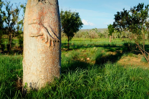
Boab Pattern

Boab Hands

How cool are these boab hands!?

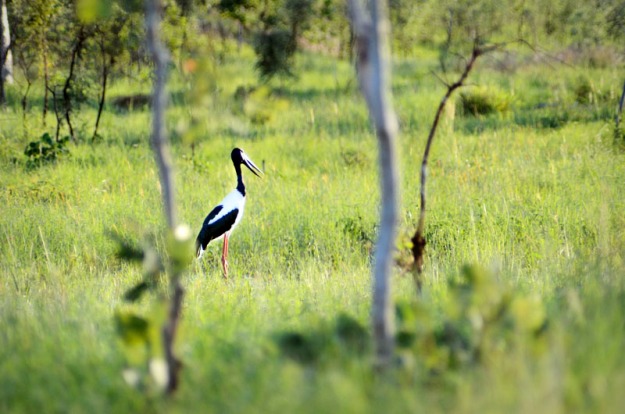
Birds IV

Jabiru I

Bird in Flight IV

Jabiru II

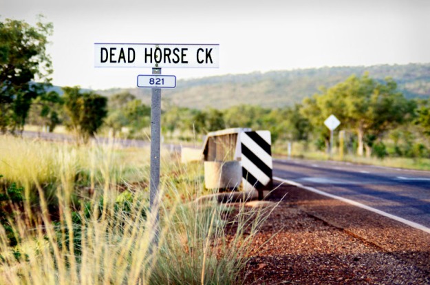
Many funky creek names in The Kimberley, such as this one and Jailhouse Creek, etc.

Dead Horse Creek

Dead Horse Creek

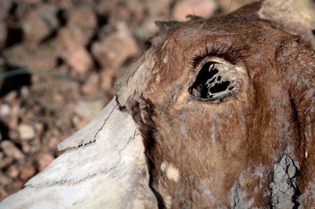
Oh look, and here’s a dead horse. How timely. Incredible bones and textures.

Dead Horse I

Dead Horse I

Dead Horse III

Dead Horse II

Dead Horse II

Dead Horse III

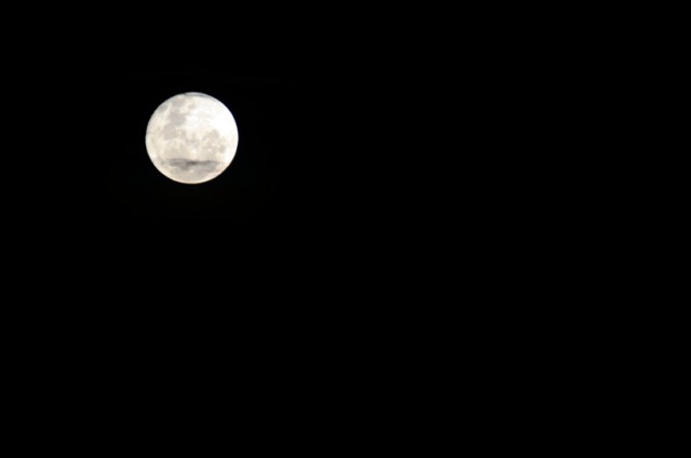
Full Moon, The Grotto

Full Moon, The Grotto

…reminds me of the howling dingos I heard south of Alice Springs.

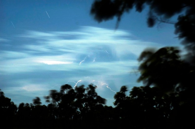
Electrical Storm I, The Grotto

Electrical Storm, Drifting Clouds and Star-Trails, The Grotto

Electrical Storm II, The Grotto

Electrical Storm I, The Grotto

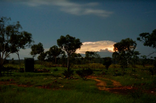
Check out this sequence from the following cloud structure…

Electrical Storm III, The Grotto

Latent, The Grotto

Electrical Storm IV, The Grotto

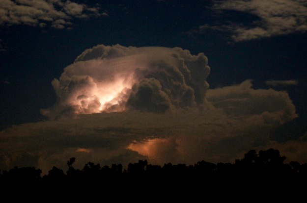
Internal Fire, The Grotto

The internal strikes are so incredibly beautiful the way they light up the cloud structure, bringing out unseen shapes and forms and with such a soft glow that spreads via the moisture particles.

Electrical Storm V, The Grotto

External Fire, The Grotto

And here are two shots of multiple internal strikes within the same cloud structure – one is an 8 second exposure, the other 7 minutes and includes some visible star-trails.

Electrical Storm VI, The Grotto

The Road Ends Here I, The Grotto

Electrical Storm VII, The Grotto

The Road Ends Here II, The Grotto

And then came dawn at The Grotto…

Dawn, The Grotto

Dawn, The Grotto

Morning, The Grotto

Early Morning, The Grotto

The Grotto

The Grotto I

You can glimpse the greenish waterhole at the bottom RHS of the above picture. And check out the steps leading down the gorge wall on the LHS foreground.

The Grotto II

The Grotto II

The water was tepid and the waterhole quite lengthy – about 30 metres to the actual waterfall. Crocs were in my mind as I breast-stroked my way to the falls despite numerous assurances that they didn’t inhabit this one.

The Grotto I

The Grotto III

Native Fig I

Native Fig I

I love Native Figs – the way they determinedly find a foothold, and moisture, within the cracks and crevices of otherwise solid stone.

Native Fig II

Native Fig II

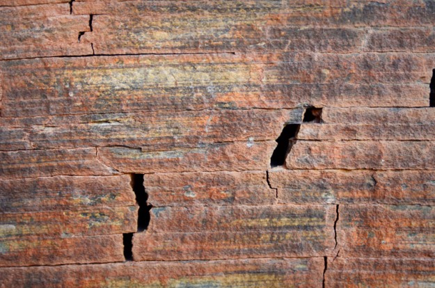
Check out the beautiful fracturing and colours of the stone wall, below…

Stones I

Stones I

Stones II

Stones II

Stones II

Stones II

And on the roof of an overhang we find…

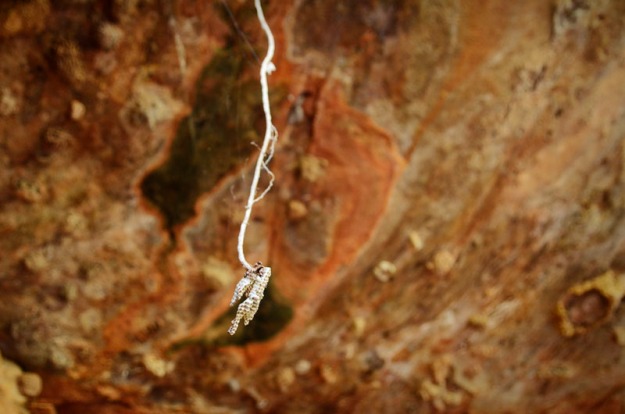
Cocoons and Hives, The Grotto

Cocoons and Hives, The Grotto

Hive I

Hive I

These little native bee beauties I found in several places but this one I particularly loved due to the choice of location – at the end of Native Fig’s root! Hard to see in these small pics but many of these little ‘cells’ were at least partially filled with what I assume was honey.

Hive II

Hive II

And everyone’s favourite creepy crawly – spiders. Or in this case dozens of spiderlings just waiting to freak you out as you walk through the web unaware…

Spiderlings, The Grotto

Spiderlings, The Grotto

Spider, The Grotto

Funky Spider, The Grotto

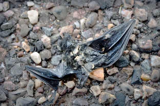
Unfortunately this cute little fella didn’t make it. Not sure if he was road-kill but he was as cute as a button and fitted in the palm of my hand.

Bat

Bat

And then it was back down to the main highway after my side trip to The Grotto.

Happy Valley

Happy Valley – view from road to Grotto

Ah, but what’s this then, ey?! Look very very very closely and you might see it.

Not-so-happy Valley

Not-so-happy Valley

Or just go to this next pic, below.

Road-Train Country

Road-Train Country

Yes, it’s the nation’s great friend…THE ROAD-TRAIN!! Please be upstanding for the national anthem.

Aussies all let us rejoice

for some of us are young and free

bah bup ba bah bah bah be bah

and I forget the rest….

Hampton's Road-train - carting for KMG

A Hampton’s (i’m-good-in-head-on-collisions) Road-train – carting for KMG (Kimberley Metals Group)

Four trailers long and over 50 metres in length. Able to stop wildlife and humans with a single strike. And great for noise and dust pollution, highway wear and tear, etc

These ones ran every 20 minutes, every day, and nearly 24 hours a day except for a couple of hours in the middle of the night. They were the only thing I could hear from The Grotto bar nature – a regular rumbling up the valley and gorge from several kilometres away.

And this is where they’re off to…

Delivery Man

KMG’s Delivery Yard

Wyndham. Just here, near the famous Croc Farm, was a handmade sign asking that road-train drivers please slow down as the resulting dust is killing the trees. And I met a couple whose house in Wyndham is located right where the driver’s did their shift change – just near the caravan park where many of them live. The changeovers occurred at very non-community-minded hours and this resident eventually took up his camera to document proceedings, sending the pics in to the authorities. Fortunately the changeover place has since been relocated. However these are just a couple of the very very minor effects that result from mining activities.

I  met a driver and his family at The Grotto and mentioned that the trucks seemed to pass every 30 minutes or so. He corrected me – every 20 minutes. They come from Ridges Iron Ore Project, 165 kilometres by road south of Wyndham, just off the Great Northern Highway which traverse The Kimberley.

He told me that part of the requirements for operating the mine included that the environment must not be visibly altered from the point of view of anyone driving along the highway. Oh, well that’s nice…BUT in fact all it means is that the destruction is effectively removed from sight…in the hope that it be ‘out of sight, out of mind’. It reminds me of the logging operations I saw in Oregon and Washington states in the USA, where a screen of trees would be left along the highway to hide the clear-felling going on behind, where whole forests were being wiped off the face of the earth.

Just today, where I am writing this up in Fitzroy Crossing, a staff member told me that Cockatoo Island in the Buchaneer Archipelago, NW Kimberley region, has been reduced to a wasteland after a mining company razed the mountain that was once there. It is now being mined BELOW SEA LEVEL!!! The current operator, Leighton said mining would continue “until August 2012 and then rehabilitation of the mine lease would commence.” How does one rebuild a mountain? Aside from the mountain, there were apparently many Aboriginal people who used to visit the island. Not any more.

But back to the iron ore mine’s shipping port in Wyndham, below…

Dirt Pile Dreaming

Iron Ore Dreaming

A mountain of iron ore, bound for China. Quite visually striking and lovely from one perspective. But quite disturbing from several others – the most obvious being where the port is located: without exaggeration, right at the bottom of one of the best lookouts I have ever been to in my whole extensive traveling life; one which has even made it into an official list of the World’s top ten lookouts.

Dirt Pile Weeping

Iron Ore Weeping

The Bastion headland, mighty even from below, is the site of one of the World’s best lookouts, Five Rivers.

The Bastion Headland

The Bastion Headland – side view

The Bastion

The Bastion Headland – front view

The Bastion

The Bastion Headland – summit detail

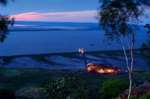
And this is the mine’s delivery yard as seen from the lookout…

Storm II, Wyndham

KMG’s Delivery Yard and Port at Cambridge Gulf, Wyndham

Notice the three barges stationed in the gulf constantly, to cart the ore to cargo ships in deeper waters. Although, I admit, the colours are quite beautiful, imagine this scene in its natural state. And contrast that against the negative impacts on the surrounding environment (and people).

The mine is situated on top of mud flats which are fringed by mangroves. Now I imagine mudflats are quite fragile and most likely contain a lot of inter-tidal wildlife. And I have seen signs asking that people NOT drive on the mudflats. Yet here we have an industrial loading yard which is apparently OK. Just did a quick google and came up with this…”The maintenance of mudflats is important in preventing coastal erosion. However, mudflats worldwide are under threat from predicted sea level rises, land claims for development, dredging due to shipping purposes, and chemical pollution.” Click here to go to that page.

Kimberley Metals Group (KMG) loading yard

Kimberley Metals Group (KMG) loading yard

And here are two guys at work, hour after hour, day after day, constantly reshaping the stockpile as the road-trains keep rolling in. Again, beautiful industrial colours, but here? I love industrial photography due to the strong colours, lines and shapes, and I realise that we need some industry of this nature…BUT we don’t need it here at the base of one of THE WORLD’S TOP TEN LOOKOUTS and IN A FRAGILE ENVIRONMENT. And we certainly shouldn’t want more of it in one of the world’s last remaining savannah-style wilderness regions which, by the way, has largely been ignored by the public and doesn’t have World Heritage Area status simply because, like The Franklin River in Tasmania 30 years ago, it is ‘out of sight, out of mind’, just like screened-off mining and logging activities.

KMG (Kimberley Metals Group) loading yard

KMG (Kimberley Metals Group) loading yard

And what happened with The Franklin River campaign to stop it being dammed in the early 80’s? What happened with The Franklin campaign is what will hopefully happen in this case – people who knew better, people who really gave a shit about the environment, carried out one of the most successful examples of community protest, putting the ‘out of sight, out of mind’, leech-ridden river directly in the public’s and politicians’ minds so that this magnificent piece of wilderness was ultimately saved in the eleventh hour. Read a more extensive account here.

But why bother saving these places that are out of sight and unlikely to ever be visited by the majority, and which could make us more money by being mined? Because what really matters is that: certain areas of nature MUST be allowed to exist simply for the sake of its existence, even if no-one ever visits them; dishonest, corrupt and exploitative politicians and corporations should be held to account; and alternatives, including utilising existing infrastructure (such as exists in The Pilbara for LNG processing), or sourcing renewable energy, should be seriously considered instead.

An aside: it’s interesting to compare the tactics of the then Tasmanian Premier, Robin Gray (who by the way, later went on to become director of Gunns Ltd which, in recent times, made a failed attempt to establish a massive pulp mill in northern Tassie) and the current WA Premier, Colin Barnett. In cynical attempts to exploit the fact that these places are relatively unknown and out of sight, in the hope of misleading the general public, Gray described The Franklin River as a “leech ridden ditch” while Barnett has described the area proposed for the LNG Processing Plant (Walmadan/James Price Point) as “an unremarkable piece of coast.”

On a coincidental personal note, the two areas of Australia that have moved me most in my life are The Kimberley and the wilderness regions of Tasmania. They have profoundly moved me in a way that is impossible to do justice to in words. They have to be experienced. And it is perhaps not surprising that one of my earliest photographic idols was Tasmanian, Peter Dombrovskis, who, like his own mentor, Olegas Truchanas, FELT a profound connection to that wilderness. Both died in it – Olegas drowned in The Gordon River and Peter died while photographing in the Western Arthur Range in southwest Tasmania.

Apologies for the overly serious nature of this post but its taken hold of me while writing and I’m covered in goosebumps and close to tears at the thought/memory of/connection with these places. So I will continue a little while longer before returning to some long overdue absurdity…

I first visited Tasmania in 1989 as a then graduating high school student. While 95% of students headed to the Gold Coast for schoolies week, a group of ten of us headed south from Melbourne to spend ten days hiking The Overland Track in Tasmania. I fell in love with it almost immediately – a place of such grandeur and wildness, with virtually no sign of the heavy hand of man. It was one of the most memorable experiences of my life, with not a drop of alcohol or other illicit substances consumed – just nature, friends and our ability to carry our homes and food on our backs for ten days in one of the most wondrous and enchanted regions on the planet.

As for The Kimberley, I first visited that on a school excursion in 1987. A mad two week dash from Melbourne via Adelaide, up the guts to Uluru, on up to Katherine, through this incredibly Kimberley wilderness (and just like now, restricted to the main highways), and down the west coast to Perth where we boarded a plane to cross the Nullabor back to Melbourne. A mad mad rush, but absolutely wonderful. And the part that has always stuck most in my mind is The Kimberley. As with parts of Tasmania, it is extremely varied in terms of landscape and climate and there is a ‘space’ which allows one to breathe, to really relax, to give in and to experience a profound connection…to something far far far greater than any of us. These types of places MUST, MUST be saved.

Currently there is tourism in The Kimberley. And tourism, when done badly, can destroy wilderness and cultures (Kuta Beach, Bali; The Gold Coast, etc). But relative to mining, tourism is death by one million fine cuts; mining destroys with only a few jagged blows.

………

And let’s not forget the waste by-products. Check out the Wyndham tip, below. This, I’m guessing, is predominantly residential and small business, for a population of around 800.

White Man's Trash VI

Wyndham Tip I

White Man's Trash V

Wyndham Tip II

White Man's Trash IV

Wyndham Tip III

……………..

And now, back to funner times. Let’s return to The Bastion and Five Rivers Lookout, where I spent New Year’s Eve 2012. Five Rivers denotes, not surprisingly, the five rivers that flow into Cambridge Gulf: The Durack; The Pentecost; The King; The Ord; and The Forrest.

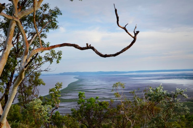
A view at dusk looking north over the mudflats, mangroves and mouth of The Ord river.

Overlooking Cambridge Gulf, Wyndham

Overlooking Cambridge Gulf, Wyndham

And another looking just slightly more north-easterly…

Dusk over Cambridge Gulf, Wyndham

Dusk over Cambridge Gulf, Wyndham

Looking south-west…

Storm I, Wyndham

Rain over The Gut, Cambridge Gulf, NYE 2012

…and west…

Dusk over Cambridge Gulf

Dusk over Cambridge Gulf, NYE 2012

…west again…

Storm III, Wyndham

Storm over Cambridge Gulf, NYE 2012

Storm IV, Wyndham

Lightning Strikes over Cambridge Gulf, 7.52 p.m. NYE 2012

A spectacular way to bring in the new year.

And now, for some other Wyndham bits…

Wyndham shop

Lee Tong Shop

Wyndham shop

Wyndham shop

Wyndham Pub

Wyndham Pub

Clouds,  Wyndham

Afternoon Clouds, Wyndham

Cloud formation over mudflats

Cloud formation over mudflats

Sunset over Cambridge Gulf

Sunset over Cambridge Gulf I

Sunset over Cambridge Gulf, Wyndham

Sunset over Cambridge Gulf II

Sunset over Cambridge Gulf

Sunset over Cambridge Gulf III

And later that night, more beautiful storm clouds that look like brain matter…

Electrical Storm II, Wyndham

Internal Fire

Electrical Storm I, Wyndham

Neural Connectivity

But now, the bit I promised earlier that you’ve all been waiting for………drum roll, please…………………

Absurdity!!!!……..

Don’t let Colin do this to The Kimberley…

Colin's Five Rivers Estate

Colin’s Five Rivers Estate

Smug and smarmy Colin hard at work even on holidays – he’s just crunched some rubbery numbers and is now happy to present to you his Five Rivers Estate proposal. Don’t let him do it. Don’t buy into his pitch. He’s as sleazy and greasy as he looks!

And don’t let him do this either…

Grotto Estate I

Grotto Estate I

Construction already underway on The Grotto Estate – here, above, we see Colin (sensibly dressed  in his high visibility construction shirt and steel-capped construction workers’ boots – he’s clearly able to identify with the common man) offering us a piece of the wild pie. Note well, Colin is wearing his ‘Bright Ideas Man’ hardhat, highlighting his inspirational leadership.

And below, overlooking his, um, I mean ‘our’ Estate.

Grotto Estate II

Grotto Estate II

And well, he just couldn’t stop himself once he got going. This one says it all really – singing his, oh, again, what I really meant to say was ‘our’ praises.

Grotto Estate III

Grotto Estate III

That’s all folks. Thanks for listening. Do what you can. Bye for now,

Hunter G

p.s. Mining banned at Horizontal Falls, described by famed naturalist David Attenborough as one of the world’s greatest natural wonders. These are located 110km north northeast of Derby in The Kimberley. Read an article about it here.

p.p.s  Worrorra Mob reject Mining! “Worrorra elders, who have native title over an area stretching from King Sound, near Derby, to Kuri Bay, 370 km north of Broome, voted last month to keep their country “clean, free and open”. They want to close the land to future mining projects and focus instead on tourism.” – excerpt from recent article ‘Battle to keep Kimberley wild, remote’ by Graham Lloyd, Environment Editor at The Australian newspaper.

Images and Text Copyright Hunter G, 2013 and available for sale (FREE for not-for-profit activities – so spread the word widely – just include a link to this blog). All profits from sales will be re-invested in Save The Kimberley activities.

Save Kimberley – Day of Solidarity – Pics Across the Globe

Hi guys and gals. Greetings from Coober Pedy, which I love more and more as each unplanned day passes.

But more importantly, check out these funny and moving pics from across the globe in support of last Sat’s Day of Solidarity in support of the brave Broome community who have been fighting Goliath for YEARS!! C/- the Broome Community No Gas Campaign

Save The Kimberley pls people. It really is one of the most profoundly moving areas I’ve EVER EVER visited in ALL my travels.

See you soon. Hittin’ the road North today for who knows where.

Happy Days,

Hunter G

Patriotic, Idiotic, Serious and Sublime

Hi folks, Hope you enjoy some of these highlights from the past few days. Click on a photo and scroll through the gallery. Any questions/comments, please fire away.

Bye for now,

Hunter G

ps Coober Pedy is a seriously weird, beautiful and frightening place. I’d forgotten how much I love it. It was apparently a pivotal location in Wim Wender’s film, ‘Until the End of the World‘ (It looks like Purnululu (Bungle Bungle) also features) …

There is also an interesting critique of the film here.

Images and Text Copyright Hunter G, 2012 and available for sale (FREE for not-for-profit activities – so spread the word widely – just include a link to this blog). All profits from sales will be re-invested in Save The Kimberley activities.

A New World Beckons – Save The Kimberley

Hi folks,

This blog came to life due to an extremely ugly proposal by an extremely greedy and ugly-spirited man, WA Premier, Colin Barnett, and his main partner in crime, Woodside Petroleum. They plan to build Australia’s (and possibly The World’s) biggest LNG (Liquefied Natural Gas) processing plant in one of the world’s last great remaining wilderness regions, The Kimberley, in far NW Australia.

But don’t worry, the blog won’t be full of hard-core political pieces – only an occasional rant. Mostly it will be a light-hearted and informative documentation of my crossing of this vast and ridiculously beautiful and varied country, Australia, from Melbourne in the SE to Broome, at the opposite corner in the NW. And here’s  a mud-map for the geographically-challenged amongst you….

Once in Broome I intend to do whatever I can to help out the courageous locals who have been fighting a very draining fight against their State Government and a huge Mutli-National Corporation for the last seven years.

So please join me on the trip and do whatever you can (however small) to help stop this disastrous proposal. Visit http://www.kimberleycampaigner.com for some simple ideas on how you can help stop this madness.

And in the meantime I would love to hear your thoughts and comments about….anything at all, really: Perhaps a response to something I post or maybe one of your random, long-lost epiphanies that suddenly reappear from the recesses of your vast and complicated mind. I’d love to hear them all as it can get a tad isolating out in the middle of a the second driest continent on Earth.

For those that would like a little more serious background before we set off on the adventure, read on below. And for those who start feeling sick in the stomach at the slightest thought of reading anything remotely serious or political, I suggest you skip to the next entry.

But before any of you go, I’d love your help naming my mighty van that is also my  mobile home for the coming months. Here he/she is

It’s a Toyota Town Ace, and boy will it be getting some out-of-town ace action, especially if I take the legendary Oodnadatta and Tanami Tracks as hoped. So far I’ve thought of Tony or Tina as in ‘Tony Town Ace’ or ‘Tina Town Ace’, but I’d love to hear your thoughts. And it’d be great to name my new mobile home soon as I’m actually already 10 days into the trip (won’t tell you where yet, you’ll have to come back) and wouldn’t want it to suffer an identity crisis like me (I went nameless for 6 months post birth….and some of you have seen how I’ve turned out).

So now, farewell to you sensitive folk. Hope to see you at my next post. Bye for now, Hunter G.

Ok, those of you still here for the heavier details, the following is an altered version of a short piece I recently wrote for the Abbotsford Convent newsletter.

‘All Roads Lead to Broome’

“Can you tell me how you would feel if the church you went to all your life, the church that you sang at with your parents, your grandparents, the church that your grandparents and your great-grandparents are buried at, how would you feel if that church was bulldozed and had a gas plant built on it? How would you feel about that because that’s exactly what’s happening to my friend Joseph.” … A question to Colin Barnett from Jon Butler Trio, a well-known music band. Joseph Roe is the Law Boss and custodian for the Northern Tradition and the Goolarabooloo people. Colin Barnett is the Premier of Western Australia.

Shortly, Hunter G will be rolling across our country searching for forgotten things from lost worlds. Cutting a diagonal path across this vast continent, Hunter is ultimately bound for Broome, in Western Australia.

Why Broome? Because it’s just north of there that Woodside Petroleum is planning to build Australia’s biggest ever Gas Processing Plant, equivalent in size to 21 Melbourne CBDs. The exact site, Walmadan (a.k.a. James Price Point), is in the SW of the incredible Kimberley region, a vast wilderness rich in many things, but to the financially powerful with an insatiable appetite, rich in the most prized possessions of all – fossil fuels and minerals.

There are hundreds of sites dotted around The Kimberley that have been earmarked as potentially lucrative in this manner. Woodside’s proposed development at Walmadan is only one of them, but it is a big one, a very big one. It is expected to bring in 6000 – 8000 workers to process LNG (Liquefied Natural Gas) and will play a very significant and, in a growing number of peoples’ minds, devastating role in the continued industrialisation of the relatively untouched Kimberley.

For anyone who has not been to The Kimberley, it is impossible to accurately describe its beauty and significance. If this project goes ahead it will destroy Broome as we know it within a very, very short time and in perhaps three decades will devastate the entire Kimberley region due to various flow-on effects. Simply on an environmental level, it is extremely important to protect this region from industrialisation. It is one of the last great remaining wilderness regions in the world and there are many alternative options with respect to building a gas processing plant.

A protest movement has been building over the last 7 years to try to stop this development. In recent months the protests have grown more rapidly as the deadline draws near (Woodside is expected to make a final decision in the first six months of 2013). The protest is about so much more than the already significant environmental concerns. It is about the devastating long-term impacts on the social, cultural and spiritual fabric of the region. If this plant goes ahead it WILL lead to the opening up of more and more areas of The Kimberley to the destructive impact of industrialisation, particularly due to the seaport which is part of this current proposal and which would create huge incentive for other developments due to the export opportunities and cost savings resulting from a pre-existing port.

Saving The Kimberley is bigger even than the Tasmanian Franklin river campaign 30 years ago. Both areas are relatively out of sight and out of mind to mainstream Australia due to their remote locations. And as a direct result, both were opportunistically described by their respective State Premiers in very unflattering and misleading terms: Colin Barnett described the relevant Kimberley coastline as “an unremarkable piece of coastline.”; and the former Tasmanian Premier, Robin Gray (if my memory serves me correctly), described the incredibly beautiful and dramatic Franklin River as nothing but “a leech-ridden ditch.”

But we can all take great hope from the Franklin protest campaign (people of my vintage and older may remember the triangular green ‘No Dams’ stickers. I was 12 at the time.) and the more recent great examples of community protest over many years such as the one that lasted about nine years but saved the Abbotsford Convent in Melbourne and created a public arts precinct instead of a private apartment development.

Please do anything and everything you can to stop this current bout of madness from leading to the destruction of one of the most significant areas of wilderness in the world. Visit http://www.savethekimberley.com/ or The Wilderness Society’s dedicated site, http://www.kimberleycampaigner.com/about/history/ for some background info and simple ideas on how you can help. Please help save this priceless gem.

Thanks for listening. I hope you enjoy the journey. Thanks and bye for now, Hunter G. xo